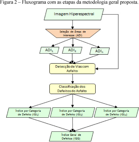
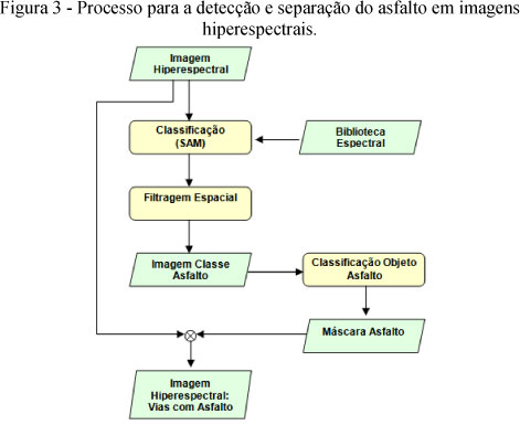
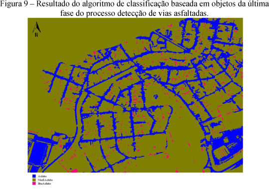
Monitoring every Brazilian road use condition is an expensive and time consuming task. This research deals with new techniques which will yield a quick survey of road surface pavement condition by using hyperspectral images from airborne remote sensing. Recently, an increasing number of images with high spatial resolution has emerged on the world market with the advent of new remote sensing satellites and airborne sensors. Hyperspectral images from digital airborne sensor have been used in this work. A new identification methodology for a pavement surface and also for classification of the main defects of the surface has been devised. The first step of the methodology is the identification of the asphalt surface in the image, by using hybrid classification based on pixel initially and then improved by objects. The second step of the methodology is the identification and classification of the main defects of pavement surface that are observable in high spatial resolution imagery. This step makes intensive use of new techniques for classification of images based on objects. The goal is the generation of pavement surface condition index from the images which can be compared to quality index of pavement surface already managed by the regulatory agency in the country.
Remote Sensing; Image Classification; Hyperspectral Image; Pavement Condition; Asphalt


