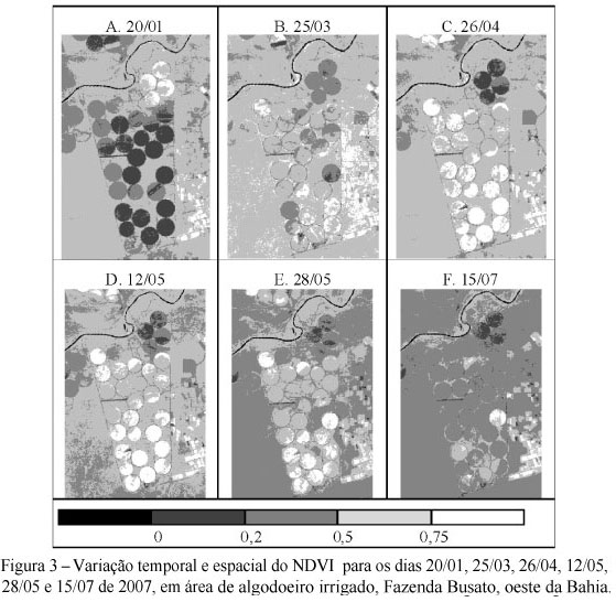
Remote sensing is currently an important tool for evaluation of net radiation and biophysical parameters over vegetated surfaces on a regional scale. In this research, the SEBAL - Surface Energy Balance Algorithm for Land and TM - Landsat 5 images were used to map and quantify the albedo (α), NDVI, surface temperature (Ts) and net radiation (Rn) of center-pivot irrigated cotton fields in the Busato Farm (13.25º S; 43.42º W; 436 m asl), western of State of Bahia, Brazil. Images from six clear-sky days during the cropping season (January to August 2007) and the corresponding meteorological data were used to run SEBAL. Results showed a clear relationship between α, NDVI, and Ts and crop development. The lowest values of α (10 to 20%) and Ts (< 24ºC), as well as the highest values of NDVI (> 0.75), occurred at the time of maximum ground cover. Net radiation decreased progressively with time, following the decrease of the incident solar radiation with increasing solar zenith angle. In the cropped center pivots, Rn ranged from 430 Wm-2 to 700 Wm-2. The remote sensing technique used in this study was consistent in capturing the temporal and spatial variability of the biophysical parameters and net radiation over the irrigated cotton, and their values are in agreement with those reported in the literature for the same crop in irrigated areas.
Albedo; NDVI; radiation balance; SEBAL


