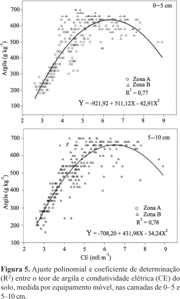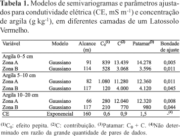
The objective of this work was to map and evaluate the spatial variability of the soil electrical conductivity (EC), measured with a contact sensor in a Rhodic Ferralsol under no till grain crops. The values of soil EC were related to soil clay content, measured by the densimetric method in georreferenced samples collected at 0-5 and 5-10 cm, in a 13 ha field. Soil samples were collected using a 40x40 m grid and densed grids of 20, 10 and 5 m spacing. Spatial continuity of EC and of clay content was modeled using semivariograms. Soil EC ranged from 1.9 to 13.7 mS m-1 with an average of 5.2 mS m-1 and coefficient of variation of 48%. The kriged map of soil EC pointed out a tendency of increase where clay levels were higher. Determination coefficients between soil EC and clay content were 0.78 and 0.77, respectively for 0-5 and 5-10 cm depth. The EC map adequatly reflects the spatial variation in soil texture for establishing the limits of management zones.
geostatistics; particle size; precision agriculture; field sensors