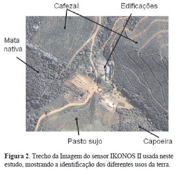
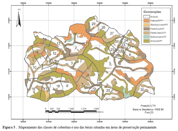
The main objective of this work was to map land use/land cover classes, permanent preservation areas and legal reserve areas in farms. The study area comprised part of the municipalities of Canaã, Araponga and Ervália, in the State of Minas Gerais, Brazil. A high resolution ortorectified image from the sensor Ikonos II with a 1-m spatial resolution was used for the study. The visual image interpretation generated 7 thematic map classes: forest cover, "clean" pasture and "overgrown" pasture, coffee plantation, build areas and areas of farming and reforestation. The permanent preservation areas were obtained from a hydrologically consistent digital elevation model. Results showed a predominance of the classes coffee plantation (24.5%) and forest cover (28.8%), totalizing more the 50% of the study area. Permanent preservation areas occupied 55.1%.
Farms; geographical information systems; mapping


