Abstract
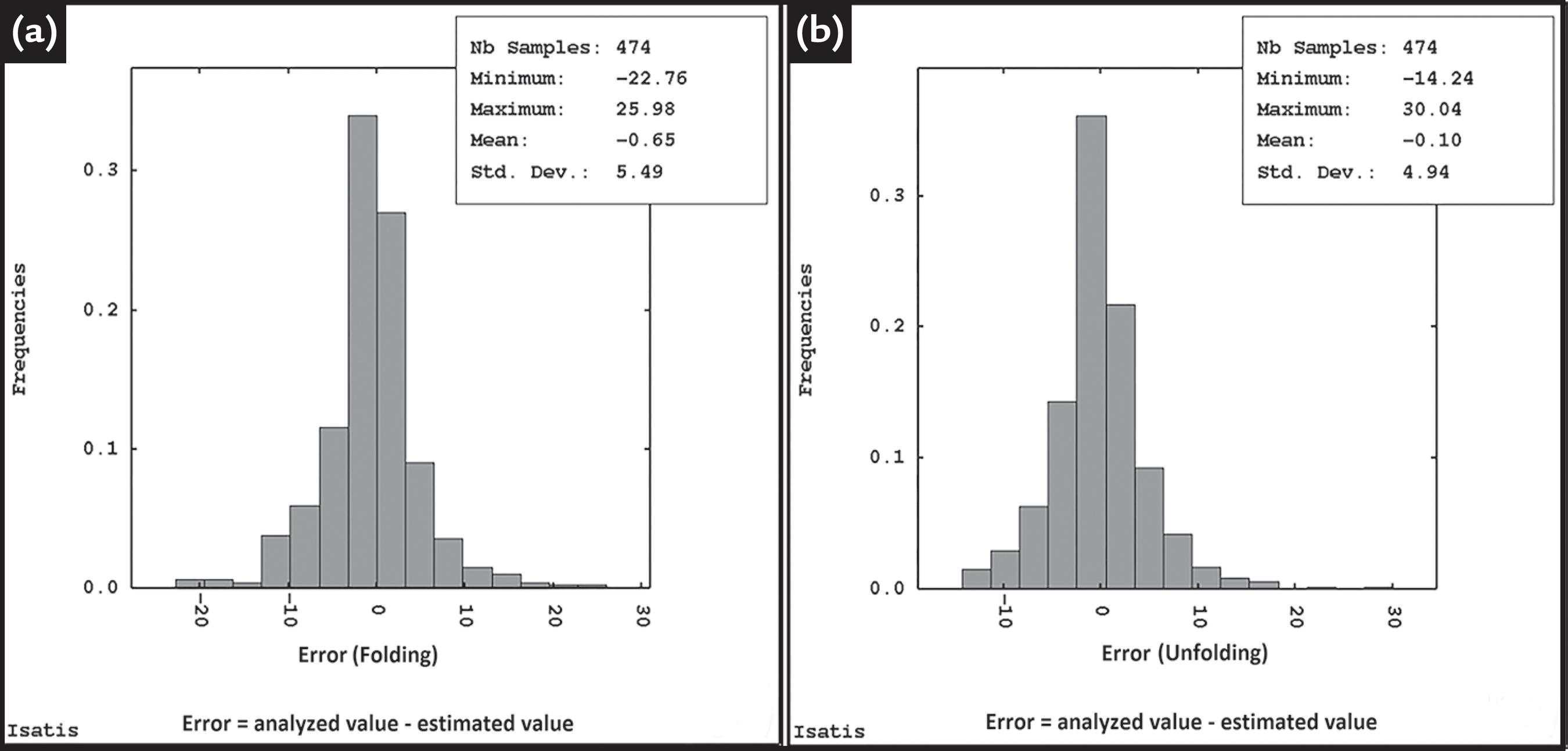
Some mineral deposits show mineralization along layers. These layers may pass through several subsequent geological events such as folding and/or severe erosional processes. Grades within these deposits tend to be correlated along orientations where the mineralization was originally deposited or along the same geological period (stratigraphic level). Consequently, some locations close to each other in terms of geographical coordinates can show uncorrelated grades. Spatial continuity analysis can also be affected by error inflicted by combining samples from different stratigraphic levels. This article uses the coordinate transformation (unfolding) to align the grades measured along the same stratigraphic level. The modification in coordinates improved the spatial continuity modeling and the grade estimates at non-sampled locations. The results showed that the mean of the relative error between the estimated value and the real value of the samples using unfolding is -0.10%. However, when using the original coordinates, the mean of the relative error is -0.65%. Furthermore, the correlation between the real and estimated value using crossvalidation is greater using stratigraphic coordinates. A complete case study in a manganese deposit illustrates the methodology.
Keywords:
Change of coordinates; stratigraphic coordinates; grade estimation; kriging


