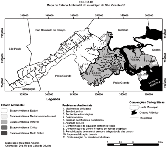
The municipality of São Vicente, object of study of this research, was included in Baixada Santista in the Geomorphologic Domain of the Coastal Province in the state of São Paulo, is characterized by the occurrence of several landscapes under the domain of zones of Range and Coastal Plains. It presents an intense urban use which is established under risk areas vulnerable to events related to mass movements and floods, facts which are aggravated due to the rising occupation process. Having in sight what was exposed, the main objective of this research was identifying and characterizing the physical and environmental agents and processes, which act on the coastal area linked to the municipality of São Vicente, as a subsidy to the actualization of the proposal of defining units of the landscape which represent the many different levels of environmental fragilities accentuated by the model of use in which the organization of the space in the area of the municipality is consolidated. Intending to achieve such objective, it was made the physiographic characterizing, the field data raising which subsided the analysis of the geomorphic, climatic, hydrodynamic parameters.
Landscape units; geomorphology; environmental planning


