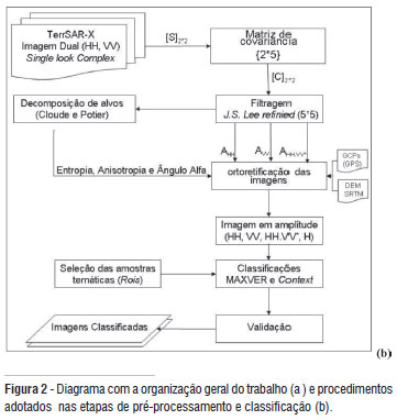
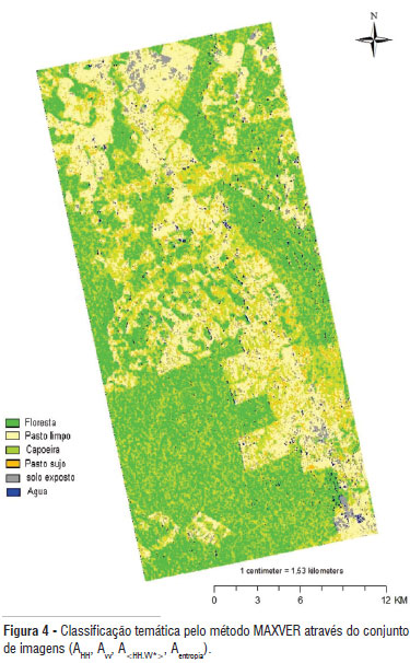
O presente trabalho tem como objetivo analisar o potencial de imagens SAR polarimétricas do sensor TerraSAR-X, no modo StripMap, para mapear o uso e cobertura da terra na região sudoeste da Amazônia brasileira. No procedimento metodológico imagens de amplitude nas polarizações A HH e A VV, A<HH.VV*> derivada da matriz de covariância, bem como da entropia A Entropia derivada da decomposição de alvos por auto-valores fizeram parte, de forma individual ou combinada, do conjunto de dados investigados. Na classificação das imagens foram empregados dois classificadores: um baseado nas funções estatísticas de máxima verossimilhança (MAXVER); e outro, o método contextual (Context). Os resultados temáticos dessas classificações foram avaliados através da matriz de confusão e pelo índice Kappa. De forma sintetizada pode-se afirmar que as componentes A<HH.VV*> e A Entropia, têm significativa contribuição no procedimento classificatório, sobretudo pelo método Context, cujo desempenho alcançou com 78% de exatidão global e índice Kappa de 0,70.
mapeamento florestal; radar; classificação polarimétrica; Amazônia