Abstract
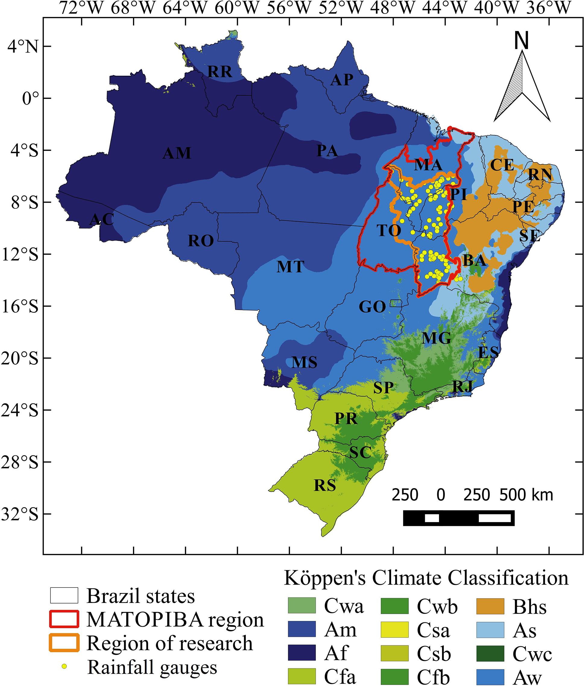
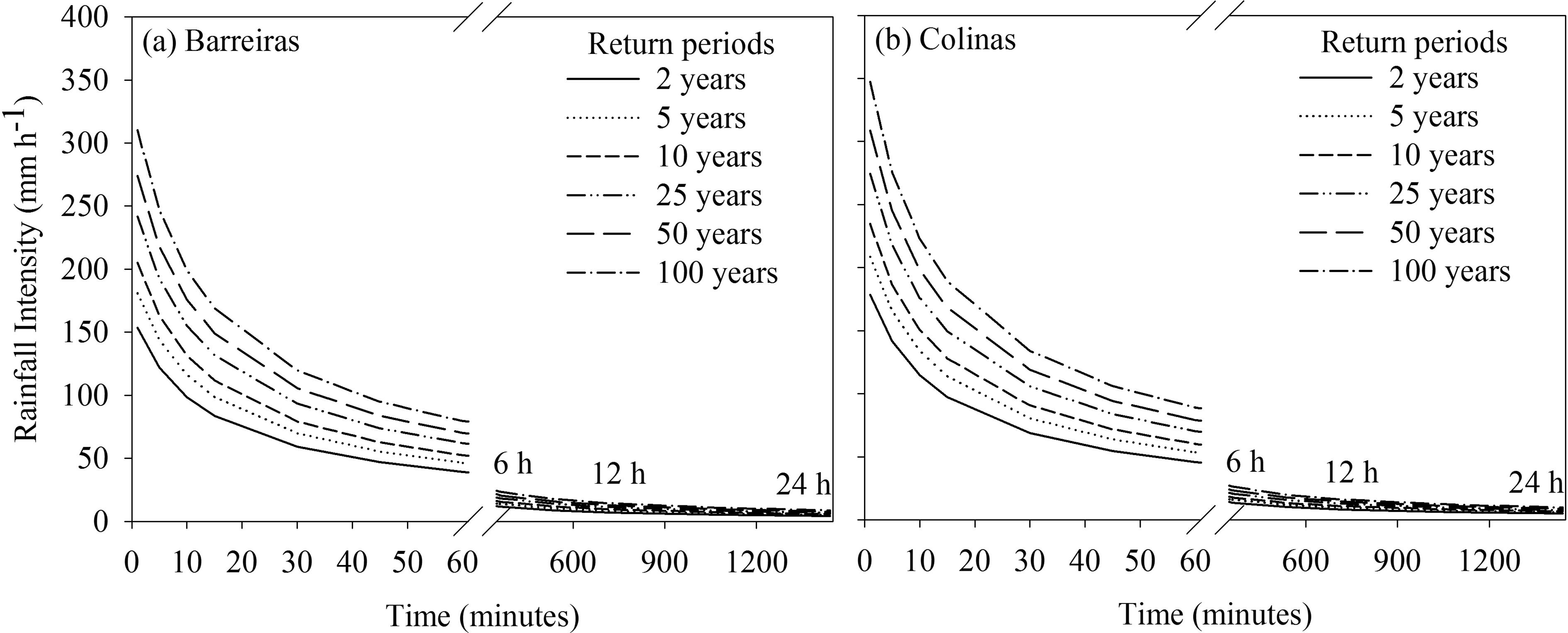
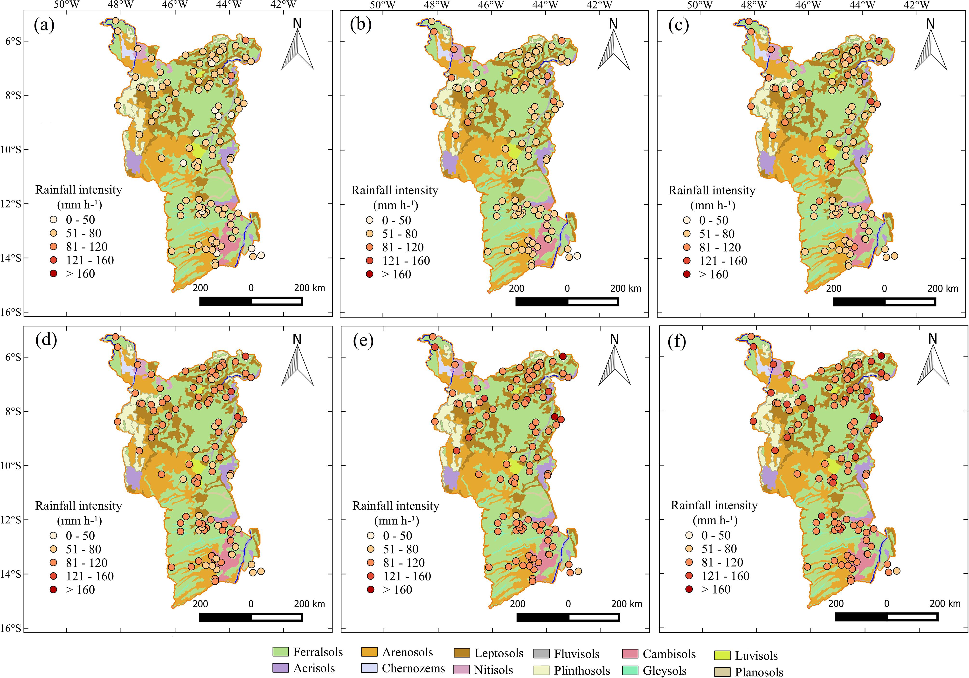
The region of study was MATOPIBA, located in the north of Brazilian Savanna biome (Cerrado), encompassing part of north/northeast of Brazil. The region has been gaining prominence in the last years due to the expansion of agricultural over this area. The aims of this study were: to adjust parameters for rainfall intensity-duration-frequency; and to identify the most vulnerable agricultural areas to erosion based on erosivity and erodibility. The rainfall intensity-duration-frequency function were adjusted using series of maximum annual rainfall event from 105 rainfall gauges. Gumbel model was the most efficient to simulate the maximum rainfall intensity, where these data were used to adjusted the rainfall intensity-duration-frequency model based on K, a, b and c parameters. The most rainfall gauges showed intensity between 51 and 80 mm h-1 and 81 and 120 mm h-1, respectively, for return period of 2 and 100 years with rainfall duration of 30 minutes. The higher rainfall intensity was observed mainly in the central-north of the region associated with rainfall systems. The rainfall intensity showed a huge capacity to cause soil erosion based on the erosivity energy, while the moderate erodibility was observed for areas with Ferralsols and Leptosols and low erodibility for areas with Arenosols.
Keywords:
Gumbel model; return years; soil erosion; erosivity; erodibility; Brazilian Savanna