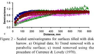
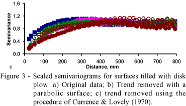
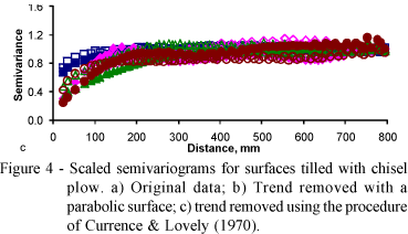
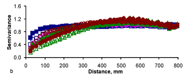
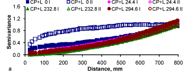
Surface roughness can be influenced by type and intensity of soil tillage among other factors. In tilled soils microrelief may decay considerably as rain progresses. Geostatistics provides some tools that may be useful to study the dynamics of soil surface variability. The objective of this study was to show how it is possible to apply geostatistics to analyze soil microrelief variability. Data were taken at an Oxisol over six tillage treatments, namely, disk harrow, disk plow, chisel plow, disk harrow + disk level, disk plow + disk level and chisel plow + disk level. Measurements were made initially just after tillage and subsequently after cumulative natural rainfall events. Duplicated measurements were taken in each one of the treatments and dates of samplings, yielding a total of 48 experimental surfaces. A pin microrelief meter was used for the surface roughness measurements. The plot area was 1.35 × 1.35 m and the sample spacing was 25 mm, yielding a total of 3,025 data points per measurement. Before geostatistical analysis, trend was removed from the experimental data by two methods for comparison. Models were fitted to the semivariograms of each surface and the model parameters were analyzed. The trend removing method affected the geostatistical results. The geostatistical parameter dependence ratio showed that spatial dependence improved for most of the surfaces as the amount of cumulative rainfall increased.
soil surface roughness; detrending procedures; roughness indices; surface configuration