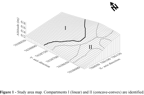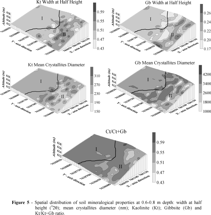
The objective of this work it was to use the geostatistics methods to investigate the spatial relationships between the physical and mineralogical properties of an oxisol planted with the sugarcane in an area of slight variations in the landform. The soil was sampled at 10 m regular intervals in the crossing points of a 100 x 100 m grid. At each point, the soil was collected at 0.0-0.2 m, 0.2-0.4 m and 0.4-0.6 m depths for the analyzes of physical properties and at 0.6-0.8 m for the mineralogical analyses. Both the Kt/Kt+Gb ratio and Kt relative crystallization level were higher in the compartment I than in the compartment II. As a consequence, the soil penetration resistance and bulk density were higher in the compartment I, while the macroporosity and Ksat were lower. Therefore, it was concluded that both the identification and mapping of a landform were efficient for understanding the spatial variability of the soil properties. Moreover, variations in the landscape shape promoted the differentiated variability of the physical and mineralogical soil properties: the more variable the landscape, the more variable was the soil properties.
Sugarcane; geostatistics; soil-landscape relationship