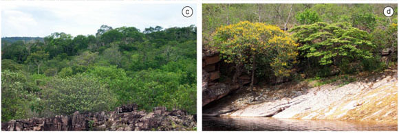
The Chapada Diamantina National Park (CDNP) was created in the midst of a densely populated area, and significant sections of the reserve are still undergoing processes of natural regeneration after intensive diamond mining activities were initiated in the mid-1800's. An up-to-date vegetation map was needed in order to indicate the types and distribution of regional vegetation assemblages in an easily interpretable manner and at an appropriate planning scale that could be easily consulted by decision makers and other interested groups at all levels of conservation (and development) planning. A vegetation map of the Chapada Diamantina National Park, and the areas immediately surrounding it, was prepared that: 1) delimits, describes, and maps the regional vegetation assemblages; 2) provides an indication of the degree of conservation of the mapped vegetation; 3) develops this information in a format that facilitates continued updating and revision as more information becomes available, enabling the monitoring of the evolution of the Park lands, and; 4) presents this information in a manner that can be easily interpreted and used for planning, management and conservation purposes. The resulting vegetation map revealed intensive anthropogenic disturbances in forested, savanna, and semi-arid areas subjected to intensive agricultural use outside of the Park boundaries. The National Park lands are generally well preserved but burning has replaced formerly extensive forest areas with open sedge meadows. In spite of intensive modification of the regional vegetation, two well preserved areas with high priority for conservation efforts beyond the National Park limits were identified and characterized. The vegetation mapping of the park itself can aid in the preparation of its management plan and in the reformulation of the existing boundaries of that reserve.
vegetation map; conservation planning; vegetation assemblages; forests


