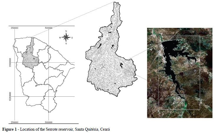
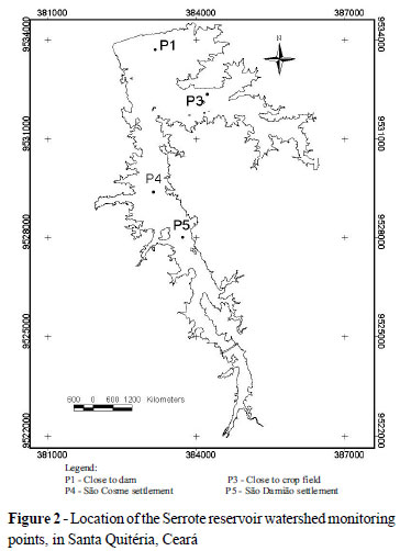
This study was carried out in the Serrote reservoir, sited in the Groaíras watershed at the northeastern region of Ceará State, Brazil. The aim was to investigate the temporal and spatial variability of water quality. Data investigation was processed using multivariate analysis/cluster analysis and GIS techniques. Samples were taken in four stations spreading out over the water body during five campaigns of collection (February, May, August/2007 and May, August/2008). The water quality parameters analyzed were: Electric Conductivity (EC), pH, Dissolved Oxygen (DO), temperature, chlorophyll 'a' concentration and Total Phosphorus (TP). Two homogeneous groups were identified, which expressed the inter-annual seasonality influence in the water quality. The highest concentration of investigated attributes occurred in 2008. At that year, the depth of the annual rainfall was 53% above the annual average. Chlorophyll 'a' and total phosphorus defined the dissimilarity between the two groups. Group 1 was composed with the better water quality and concentrations of attributes were close to the recommended limit defined by resolution 357/05 of CONAMA. Whereas Group 2 presented average concentrations of chlorophyll 'a' and total phosphorus two times greater than the ones registered in Group 1, there for been above the limit established by CONAMA (357/05) for human consumption. The reservoir presents characteristics that point toward eutrophization due to the use and management of the soil around said reservoir.
Water quality; Cluster Analysis; Eutrophization