
Abstracts
This article analyzes the main objectives of the scientific voyage to circumnavigate the earth, undertaken by the United States from 1838 to 1842. Charting was one of the most important of the scientific and strategic goals of the exploratory voyage. The initiative for the undertaking was the search for exact positioning on the high seas after the establishment of the longitude system, when nautical charts and maps from various countries were compared, and other, new ones were drawn. The United States participated in this international effort, leading to the creation of its own cartographic system.
United States; voyages and voyagers; longitude; nautical charting
Analisa o principal objetivo da viagem científica de circunavegação realizada pelos EUA entre 1838 e 1842. A tarefa de mapeamento destaca-se entre outras metas científico-estratégicas da viagem exploratória. A iniciativa da empreitada foi movida pela busca da exata localização em alto-mar após a instituição do sistema de longitudes, quando cartas náuticas e mapas de vários países foram conferidos, e outros, novos, desenhados. Os EUA participaram desse esforço internacional, dando início à constituição de um sistema cartográfico próprio.
Estados Unidos; viagens e viajantes; longitude; mapeamento náutico
ANALYSIS
The objectives of the U.S. Exploring Expedition's circumnavigation (1838-1842): longitude, nautical charting and the establishment of modern geographic coordinates
Mary Anne Junqueira
Professor at the History Department and at the International Relations Institute/Universidade de São Paulo. Rua Lisboa, 225/122 05413-000 - São Paulo - SP - Brazil maryjunq@usp.br
ABSTRACT
This article analyzes the main objectives of the scientific voyage to circumnavigate the earth, undertaken by the United States from 1838 to 1842. Charting was one of the most important of the scientific and strategic goals of the exploratory voyage. The initiative for the undertaking was the search for exact positioning on the high seas after the establishment of the longitude system, when nautical charts and maps from various countries were compared, and other, new ones were drawn. The United States participated in this international effort, leading to the creation of its own cartographic system.
Keywords: United States; voyages and voyagers; longitude; nautical charting.
We seek to understand the extensive nautical charting undertaken by the U.S. Exploring Expedition, (U.S. Ex. Ex. for short) on the first American circumnavigation. The scientific, peacetime exploration was the exclusive responsibility of the US Navy. Circumnavigation was also undertaken by other countries, such as England, France, Spain and Russia, in order to survey unknown areas of the globe. First, we will recount some relevant aspects of the expedition; next, we will discuss the establishment of longitudes on the high seas and the establishment of modern geographic coordinates and lastly, we will describe some specific aspects of US mapping.1 1 The five volumes of the voyage narrative used in this article are available online. See the Smithsonian Institution, undated.
Although the great expedition had scientific, economic, political and diplomatic objectives, mapping of parts of the Earth was its principal goal. This goal was based on the geopolitical purpose of the voyage that required four years and, afterwards, a good deal of ink when preparing the reports, including a written narrative by the commander published in five volumes, 18 scientific volumes also prepared by the commander and scientists, and an atlas. It sought to survey the coasts of specific continents and islands, recognize the mouths of rivers, ports and ocean currents, and identify shoals and other submerged geographical features that could pose a danger to ships.
Commanded by Lieutenant Commander Charles Wilkes, the members of the expedition set forth from the port of Norfolk, Virginia in 1838, finishing the trip in 1842. There were six ships: the sloops of war Vincennes and Peacock, the brig Porpoise, the storeship Relief and the tenders Sea Gull and Flying Fish (Wilkes, 1845). Three hundred forty-six men embarked, including 37 officers, most of whom were cartographers (many in training), eight scientists and two artists. The officials were responsible for the primary work of the expedition: mapping.
Captain Charles Wilkes was an ingenious specialist in nautical mapping and interested in the possibilities of meteorology, a field that was just beginning to be defined. The scientific and artistic tasks were the responsibility of the civilians on board: James Dwight Dana (mineralogist), Titian R. Peale and Charles Pickering (both naturalists; the former interested in fauna and the latter in human societies), Joseph Pitty Couthouy (naturalist and conchologist), William Rich (botanist), William Dunlop Brackenridge (botanist and horticulture specialist), John W. W. Dyes (taxidermist), Horatio Hale (philologist), and Alfred Thomas Agate and Joseph Drayton (artists). Many of them owe their careers to the expedition.2 2 The expedition also included the interpreter, F.L. Davenport, who, however, abandoned the voyage upon arrival in Rio de Janeiro. Charles Wilkes (1845, v.1, p.XXXIV-XXXVI), in the voyage narrative, mentioned the mathematician and high-precision instrument specialist John W. Brown among the team of scientists. He focused on the more technical work. They collected forty tons of vegetable, animal and mineral specimens, organized later in collections that were the foundation of what became the Smithsonian Institution in Washington, especially the capital's Botanical Garden.3 3 In 1985, the National Museum of Natural History of the Smithsonian Institution, in Washington, sponsored an exhibition on the U.S. Exploring Expedition to commemorate its anniversary, recognizing the importance of the trip for the creation of the Institute. A beautiful book was published on the expedition/exhibition after years of work by the museum's researchers (Viola, Margolis, 1985).


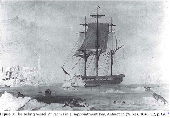
Charles Wilkes' most exalted finding, however, was the proof that Antarctica is a separate continent. Many travelers had reached this part of the globe, but the captain of the U.S. Exploring Expedition obtained 'proof.'. From that time on, maps of the Earth were redrawn to include the seventh continent. A large portion of the east of Antarctica was named Wilkes Land.
Two years of preparation were required after approval of the expedition by Congress in 1836 - after heated debates. Precision instruments were acquired - many obtained in Europe by the commander himself a few months before lifting anchor (Borthwick, 1965). Vessels were adapted for the objectives of the voyage, and specialized personnel were recruited, including the crew. The mobilization of the scientific and military teams was intense in the years before departure.
The expedition was an opportunity to prepare new scientific personnel and train officers in the art of nautical cartography. The dimensions of the operation were surprising, given that at that time the United States sought to consolidate the nation-state and concentrated efforts on expanding its borders, with aggressive land conquests pushing west from the Appalachian Mountains to the Pacific.5 5 With Independence, in 1776, the borders were expanded from the Appalachians to the Mississippi. In 1819, Florida was annexed (until then a Spanish territory). In 1803, Louisiana was purchased from France. During the voyage of the U.S. Exploring Expedition (1838-1842), the nation's borders reached the Rocky Mountains. After the war with Mexico (1846-1848), the United States annexed half of the land of the Latin American country, reaching the Pacific. At that time, the territory of the United States was only two thirds of its current territory (Meinig, 1993).
Initially, the approach adopted to study the expedition was to understand it as one of the many voyages of the same type, undertaken by other countries. As mentioned, between 1750 and 1850, England, France, Spain and Russia sponsored circumnavigation expeditions (Vinkovetsky, 2001; Richardson, 2001; Baeza, Leiva, 2004). Similar to the U.S. expedition, they were generally carried out by the Navy (normally in warships refitted for peacetime tasks) with the primary objective of performing nautical mapping. The United States' expedition was strategic, just like that of the other powers, indicating that the United States already sought a position in the world. Creation of its own charts provided autonomy with respect to Europe, and ensured the safety of the country's ships (Junqueira, 2008). It is important to note here that the famous circumnavigation voyage of the Beagle had similar objectives, but time has placed this primary objective in the background due to the impact that the naturalist Charles Darwin's theory on the evolution of species has had on the scientific community since that time.
I understand the exploratory voyage undertaken by the Americans - and others based on illuminist rationality - to be a colonial expedition, whose results were aggregated in various texts and images (maps among them) prepared from a specific "place of enunciation" (Said, 1992), a place that, in general, was situated at the center of knowledge, forged by a discourse of authority over the locations visited (Salvatore, 2007, p.9-30). The many results of the voyages, not always expected, were the products of complex and varied encounters (Pratt, 1999).
The fact that the United States embarked on a trip of this nature when it was still expanding across the continent reveals the imperial culture that has marked the country's trajectory since its foundation (Kaplan, Pease, 1993; Joseph, Legrand, Salvatore, 1998). However, we must stress that the United States is a country with a complex culture and politics and cannot be understood solely through the records presented here. The culture of dissent, which emerged along with the country's independence in 1776, is well known (Cornell, 1999). For example, Congress delayed approving the expedition because some congressmen feared that the country would establish colonies like the European countries did, since they sponsored similar voyages (Philbrick, 2005, p.27-65).
At the time, the French circumnavigations were admired (especially that of Louis-Antoine de Bougainville, from 1766 to 1769, and that of Jean-François de Galaup, comte de Lapérouse, from 1785 to 1788), as was the Russian circumnavigation of Adam Johann Ritter von Krusenstern (from 1803 to 1806). However, James Cook's three trips around the world were paradigmatic (the first from 1768 to 1771, the second from 1772 to 1775, and the last from 1776 and 1779), and became a sort of model expedition with respect to how to understand the world, the type of voyage report, the inclusion of scientists and cartographers (civilians or not), and communication of the results of the scientific voyage: charts, scientific reports and the narrative of the voyage itself (Richardson, 2001).
Characterized by rationality and by the certainty of scientific experimentation, Cook is considered one of the first officers to specify modern longitude in a long voyage, for the purpose of nautical charting (Richardson, 2001). The narrative of Charles Wilkes' voyage clearly has that of James Cook as a model, along with those of other navigators, but it has characteristics specific to the U.S. situation, in addition to the personal circumstances of the commander. After his return, the captain faced court martial, accused of breaking Navy rules by flogging his crew members more than permitted. Additionally, irascible and authoritarian, he made enemies among the officers, who testified unconditionally against him.
Why were the nations in that era committed to such large investments in charting? This question led me to investigate aspects of the science of that period, which debated how to correctly determine location at sea. The high risks of certain trips and the financial losses due to unknown accidents at sea made accurate nautical charting and precise determination of location during long voyages pressing needs; at the center of these debates was how to determine longitude far out to sea.
Uncertainty with respect to location on the high seas and the dispute for the Pacific
At the time during which these expeditions were undertaken, there was a consensus among Western navigators regarding latitudes, and these conventions were already followed by the military, scientists and navigators of various nations. With the help of some instruments and astronomical observations - movements of the sun and other stars - latitude could be precisely calculated. Moreover, based on two other fixed points - the North and South Poles - the Earth's maximum circumference was determined and the Equator defined as zero latitude. However, the geographical convention known as longitude had not yet been configured. In other words, there was a consensus among nations with respect to the parallels on the globe, but there was disagreement on the establishment of meridians.
Before discussing the debate on the accurate establishment of longitude at sea, we would like to note the debates on the precise shape of the Earth that took place in the first half of the eighteenth century. There were discussions in scientific forums that supported certain scientific theories that required voyages to determine if the French or the English were right. French astronomers believed that the Earth was a sphere; the English, based on the theories of Isaac Newton, defended the idea that it was a spheroid, flattened at the poles (or an ellipsoid with flattened rotation). This hypothesis was rejected by the Italian astronomer Giovanni Domenico Cassini, then resident in France. The scientific advances of the era were among the disputes and rivalries marking the positions of power of the two nations, and caused the scale to lean either to one side or the other.
The French forged ahead and the Académie des Sciences sponsored two scientific expeditions to perform measurements and prove the theories. In 1735 a group of scientists headed to South America to carry out measurements near the equator (Peru and the Quito region), with permission from Spain. Led by the mathematician Louis Godin de Odonnais, it became better known as the voyage of the geographer Charles-Marie de La Condamine (1992), who became the real leader of the expedition and was one of the few survivors of the exploratory voyage. In 1736 the French Académie sent the scientist Pierre-Louis Moreau de Maupertuis to Lapland, at the North Pole, for similar measurements. In 1737, before the return of La Condamine, Maupertuis demonstrated results to the Académie, proving the hypothesis of the English scientist Isaac Newton (Pratt, 1999, p.52-55).
At a time when Europe searched the globe for places to establish colonies, navigation was still based on latitude, detailed geographic charts and the vast experience of the pilots. Latitude and longitude could be determined on land, but there were no means for correctly establishing longitude at sea. In other words, there were many inaccurate charts.
The attempt to achieve international consensus on longitude was a big problem in the eighteenth and nineteenth centuries. However, man has sought to calculate and trace the meridian lines since antiquity, and Ptolemy was one of the great thinkers who pondered the question. In the seventeenth century, Galileo Galilei also attempted this by attaching pendulums to mechanical watches and, later, following the trajectories and the eclipses of Jupiter's moons (Bedini, 1991; Rossi, 1989). Nevertheless, the institution of meridians became vital during the period mentioned. The Portuguese, who undertook great voyages before the Spanish, were expert sailors who maintained and rebuilt their empire through the circulation of those skilled in nautical techniques and science in the eighteenth and start of the nineteenth century (Kantor, 2010).
At the end of the fifteenth century, with Spain's entrance in the 'race,' the two nations agreed on their possessions in the New World. As is well known, they partitioned the Earth with the imaginary line known as the Tordesillas line in 1494 (Cortesão, 1957, 1960). An important reference for navigation during that era was the Ferro line, named after a west Canary island. Based on illuminist rationality and mathematical calculations used for calculation of space and the form of the globe, the objective of the two countries was more accurate positioning on the high seas, to define and map points of interest or danger for navigation, reduce costs and ensure the free flow of goods, avoiding the losses common to long voyages. In other words, they sought ways to make voyages safer and avoid financial losses of various types.
To indicate the scope of the problem, the case of the the Solomon Islands6 6 I already discussed the Solomon Islands case in a previous article. I discuss them again here due to the importance of the debates surrounding the inability to locate the archipelago in the scientific and military communities on both sides of the Atlantic (Junqueira, 2008). , in the Pacific near New Zealand, is revealing. They were first seen in 1568 by the Spanish navigator Álvaro de Medaña de Neyra. Reconnoitering the archipelago, the navigator attempted to draw a map to record its location. However, in later voyages, the islands were not found. When they were finally located, errors in distance were seen as the problem, because they varied from 180º to 170º, which corresponded to three hundred to seven hundred leagues.7 7 Nautical leagues were itinerary measurements that varied, depending on the period and the government, and from nation to nation.
There were other errors related to the location of these islands. In 1768, the Scottish navigator Alexander Dalrymple mistook them for New Guinea. In the same year, the Frenchman Louis-Antoine de Bougainville 'discovered' the same islands again, but did not recognize them as the Solomon Islands and christened them - as expected - with his own name: Bougainville Islands (Brosse, 1983, p.20). Other navigators made similar errors. Although it was already possible to establish longitude accurately, the exact location of the archipelago remained uncertain at the time of the U.S. Exploring Expedition. As expected, geographical questions and inaccuracies were resolved as time passed.
The well-known Russian commander Adam Johann Ritter von Krusenstern, who circumnavigated the Earth between 1803 and 1806, told the Americans of his questions in a memorandum in 1837. In his opinion, even though nautical charting had advanced, the charts for some Pacific islands were inaccurate.
IV. The Solomon Islands - These islands have partly been visited by D'Urville and Shortland, partly by D'Entrecasteaux; and several English ships have at different times sailed through them; but a complete survey of all the islands composing this great archipelago is still wanting. It is indeed very singular that, of all the navigators who have lately visited the Pacific Ocean, none have ever attempted any thing like a systematic survey of these islands, with the exception of D'Entrecasteaux, who, at least sailed along the southern islands from east to west, and thus greatly improved the hydrography of them. I have published, in the year 1827, a chart of these islands: (Carte Systématique de l'Archipel des Isles Salomon.) Having collected all the materials that were to be had at that time, many of them in apparent contradiction to each other, I endeavoured to reconcile them, and to delineate the lands belonging to this archipelago, to the best of my judgment (Wilkes, 1845, v.1, p.369). h:8 8 In this and other citations from texts published in other languages, free translation is used.
The difficulties led the Russian commander to gather the existing charts, even when imprecise and contradictory, to obtain a more accurate charting of the islands using his own measurements and comparison with charts prepared by other travelers. We see, by the statement above, that the task was left to later voyagers.
Russian, European and American military personnel and scientists corresponded regularly, including information and suggestions related to circumnavigation voyages. As an example, the voyage report prepared by Wilkes cited Krusenstern several times. Especially interesting was the thanks James Kirke Paulding, secretary of the Navy, gave to the Russian Commander for the valuable information sent to the Americans (three volumes of memos, maps and charts), which improved planning for the U.S. Exploring Expedition. In the document, Krusenstern provided a list of the regions and islands whose charting needed to be verified.
The charting and location problems were international in nature and involved various countries. Although Cook was able to determine longitude at sea, there was much still to locate and chart, especially in the Pacific. In addition to the Solomon Islands, Krusenstern mentioned many other Pacific islands in his memo to the Americans, including the Paumoto (modern Tuamotu, in French Polynesia), so that their locations could be verified and charted.
The nations competed among each other, especially in the dispute for the Pacific. At the same time, though, they discussed their problems and possible solutions through diplomatic memorandums and official letters, but principally through the information and thoughts in their voyage narratives. Some verified the charts of others, in an attempt to unify knowledge of the Earth, but without putting aside competition and power disputes.
The results of these circumnavigation voyages, as with other explorations with both scientific and strategic purposes, were carefully edited before publication. Some maps and charts drawn during or after the trip were kept confidential, while others were published and sold (Pedley, 2007; Edney, 2007). In addition to demonstrating the technical abilities of the nation who sponsored the feat, publication enhanced the country's role in the international effort to accurately map the Earth, as mentioned above. The race to that region was considered a second wave of exploration and 'discoveries' by the Europeans, when new charts were redrawn and those used until then were verified (Finney, 1998).
Longitude and the establishment of modern geographic coordinates
The theme of the search for a definition of longitudes is known to historians of cartography, but for the purposes of this article, it should be reinforced. As highlighted, the search for solutions for the problem energized governments, scientists, the military and diplomats. Since the seventeenth century, various nations had invested in building astronomical observatories, hired astronomers and created specialized organizations. Among other objectives, they were pressured by the urgency to measure longitude. England and France - the maritime powers of the era - stood out from the rest. France established the Observatoire de Paris in 1669, and England the Royal Observatory of Greenwich in 1675.
However, other countries were close behind: Spain inaugurated the Real Observatório Astronômico de Madrid in 1790; in Portugal, the Academia Real das Sciências established an astronomical observatory in Lisbon in 1787, and the Navy's exclusive observatory began operations in 1798. The Imperial Observatório do Rio de Janeiro was inaugurated in 1827, before the American observatory was established in Washington in 1842 - the year in which the U.S. Exploring Expedition returned home. Note, though, that before the construction of the national observatory in the United States, the observatory at Harvard College, founded in 1839, was a reference for U.S. astronomers and cartographers. The Russians, in turn, created the Pulkovo Observatory in 1839. The astronomers and military personnel at these institutions pondered the international question of the time: determination of longitudes. Throughout the nineteenth century, many countries built their own astronomical observatories (Rieznik, 2010).
In 1714, England created the Board of Longitude, the name by which the Commissioners of Discovery of the Longitude at Sea became known, confirming the urgent nature of the need to accurately measure the meridian. As stated, the Atlantic was still considerably unknown, even the areas near Great Britain. On low-visibility days, common in the region, disasters were common. Among the most famous shipwrecks of the era was that of the Isles of Scilly, near England (about 40 km). It was one of the reasons the Board of Longitude was created. In 1707, in dense fog, four British ships commanded by Vice Admiral Cloudesley Shovell wrecked, killing two thousand men.
The Board of Longitude represented the best of knowledge and technology related to navigation, astronomy and mathematics. It brought together influential scientists, including Isaac Newton. Despite all efforts, the problem persisted as a subject of debate among, for example, politicians, military personnel, scientists and traders in the seventeenth and eighteenth centuries, and into the nineteenth century.
Beginning in the early eighteenth century, the nations stimulated the development of calculations in measurements during sea voyages to create more accurate maps. England -which had the largest navy at the time - took the lead. The octant, an instrument named due to its format, an eighth of a circle, was proposed by the Englishman John Hadley to the Royal Geographical Society in 1731. The apparatus allowed calculation of longitude by taking the height of the stars as a reference, perceived through two mirrors. It was the first double-reflection instrument capable of reading angles of up to 90º. In 1714, the English Parliament passed the Longitude Act, which established an award of twenty thousand pounds for the inventor of a method capable of determining the longitude of a location with an error of less than half a degree.
The establishment of awards for whomever solved this problem was not restricted to England; for example, in 1598, King Phillip III of Spain offered an award and a lifetime pension to whomever solved the longitude problem. In 1616, Galileo, responding to the call, proposed using the eclipses of the moons of Jupiter to resolve the question. The debate mobilized scientists and officers of various nations, who argued whether the solution would be astronomical or mechanical. The pendulum watch was discarded because, in general, it lost accuracy at sea; therefore, if the solution were mechanical, the apparatus was yet to be invented.
Contrary to latitude, established using instruments and the position of the sun (when the sun is at its highest, the zenith), longitude is based on time. For this purpose, a reference meridian had to be established. It seemed 'natural' to recognize that the Earth's largest circumference would be zero latitude (the Equator), but the selection of the meridian reference line would be arbitrary, and could be located in different places depending on the calculations used.
To establish exact location at sea, both latitude and longitude are needed. However, longitude required a more complex operation. One would need two simultaneous references, in hours, in two different locations: one taken at the reference meridian (generally the capital of the country), and the other at the location of the ship (at sea or at distant shores).
Accuracy was inherent to the process because, if identified in hours, a degree of longitude could correspond to 125.93 km if near the Equator. Due to the shape of the planet, a degree of longitude at the Equator was equal to the distance mentioned above, but is much shorter when near the Poles. No solutions were readily apparent. How could the question of measurement in degrees be resolved, on moving ships? How could precision instruments resistant to the various climate conditions on board be built?

The feat of watchmaker John Harrison, who worked on his mechanisms for forty years to invent the high-precision marine chronometer, is well known. His device ensured accuracy in longitude measurements on long sea voyages.9 9 Dava Sobel's small book is worthy of note. It was published for a student audience, but was widely read in the United States by the general public. Companhia das Letras published a Portuguese translation (Sobel, 2008). He was very inventive and created a type of clock placed in a wooden box, in which a set of springs compensated for discrepancies and permitted accurate measurements (Sobel, 1995, p.54-73). However, many scientists focusing on an astronomical solution rejected Harrison's mechanical invention and delayed recognizing that someone without the intellectual and scientific training of officials and scientists had solved the problem. In the end, while latitude was determined by observing the stars (especially the sun), the solution for determining longitude was mechanical. The first circumnavigation voyage to use Harrison's instrument was James Cook's second expedition, from 1772 to 1775.
On this issue, which mobilized monarchs and famous scientists, one question stands out: what were countries focusing on at the end of the eighteenth and start of the nineteenth century? In addition to acquiring knowledge and control over geographical space, based on the above we can affirm, without a doubt, that they were establishing modern geographical coordinates. The institution of these coordinates was related to the race of the world powers at that time, especially between rivals England and France. And what did these voyagers do, especially those who circumnavigated the globe? They remapped the world. In the Pacific Ocean - where the inaccuracies were concentrated - cartography was developed practically from scratch. After they obtained chronometers, navies were able to verify and correct their charts. In the United States the situation was similar.
With the new ability to accurately determining longitude, there was still a problem: a reference meridian needed to be chosen. There were no international standards. London used the line passing through its astronomical observatory, the Royal Observatory of Greenwich; France used another, which passed through the Observatoire de Paris. Some Muslim countries used Mecca, some Catholic countries used Jerusalem, and so on (Pratt, 1942). In short, maps were not uniform and there were no international conventions for map drawing; each country drew maps with respect to a zero meridian, which could pass through London, Paris, Jerusalem, Mecca, Copenhagen, etc.
The choice of a prime meridian was not imbued with the reverence we now note when mentioning Greenwich, a tourist destination and a reference point in the British national memory. For many, it is emotional to step on the zero meridian dividing the world into East and West; during the day, one can see a resistant line drawn on the ground, and at night an intense green laser beam cutting the dark night, representing the prime meridian of modern geographic coordinates. It was man, in the twentieth century, who created the Greenwich ceremony. Before this, to establish a meridian one simply drew a line like any other, and in general countries chose more than one of these imaginary lines, depending on the work to be performed.
The charting performed by the U.S. Exploring Expedition used the Greenwich meridian as a guide, along with The Nautical Almanac and Astronomical Ephemeris, published since 1767 by the Royal Greenwich Observatory, in London. Soon, other nations created their own references. They were publications that provided astronomical calendars and data very important for navigation and, as a consequence, the decisions to be made at sea. The octant, the telescope, the chronometer, and the barometer, among other instruments, plus the nautical almanac, were vital instruments for world navigation.
Although the Americans chose the London meridian in expeditions like that studied here, the United States had already established others within its borders, on which it based land mapping. In Washington D.C., a meridian was drawn through the cupola of the Capitol Building, and another through the White House. In addition to these, others were drawn in the cities of Philadelphia, New York and Boston, among others. The maps of the era show that the choices used when drawing atlases of the country were based on different meridians. However, in September of 1850, Congress approved an act stating that the meridian passing through the astronomical observatory in Washington should be used for astronomical purposes and that of Greenwich for nautical purposes (Pratt, 1942, p.236).
Before discussing some aspects of the charting of the U.S. Exploring Expedition, the establishment of the zero meridian - or prime meridian - deserves some discussion. Until the second half of the nineteenth century, while it was possible to accurately determine the meridian with the help of a chronometer, there was still no international consensus on the establishment of a prime meridian to be used by all countries. In general, for long voyages, navies adopted the Greenwich or Paris meridians and their respective nautical almanacs (Pratt, 1942). As we saw, these choices caused problems when preparing maps, because each country used a different location reference.
In an attempt to set standards for modern geographical coordinates, at the invitation of President Chester Alan Arthur (1881-1885), the United States hosted the International Meridian Conference in October 1884 in that country's capital, with delegates from Austria, Brazil (Louis Cruls, head of the Imperial Observatório do Rio de Janeiro), Colombia, Costa Rica, France, Germany, Great Britain, Guatemala, Hawaii, Italy, Japan, Mexico, Paraguay, Russia, Santo Domingo, San Salvador, Spain, Sweden, Switzerland, United States, Venezuela and Chile. Once again, the great dispute was between England and France - the maritime powers of the era. The two nations competed ardently to have the meridian drawn by their astronomers through their capital city adopted as the standard. In the end, with the strong support of the United States - already a world power outside of Europe - Greenwich was chosen as the prime meridian, and those who voted in its favor agreed to recognize the coordinates decided on at the conference.
I do not intend to cover specific aspects of the International Meridian Conference in depth, but it is interesting to note that Brazil and France abstained from voting. Brazilian ships usually used the Paris meridian on long trips. France even proposed that a standard meridian was not necessary, when in perceived that the delegates were leaning towards the English meridian (Andrewes, 1996). Those who did not participate in the meeting and those who voted against using the English meridian delayed adoption of the standards voted on there. French cartographers, for example, continued using the Paris meridian as a reference for many years. Slowly, those against London began to adopt the international standard and used the Greenwich meridian as a longitude reference.
Only with the establishment of a prime meridian was it possible to draw the grid of meridians (longitude) and parallel lines (latitudes) for the planet, used even today. It was decided that the Greenwich meridian would divide the globe into east and west, the East and the West. The conventions indicated that the measurements to the west would be marked as positive (+) and those to the east would be marked negative (-). This convention, as we know, assumes that the voyager traveling to the west should add an hour for each time zone crossed, and subtract an hour for each time zone crossed heading east.
From then on, other conventions were established, such as the International Date Line, drawn exactly opposite to the Greenwich meridian. It cuts the Pacific ocean from one pole to the other and is known as the line which, when traversed by travelers from east to west, causes them to arrive at their destination at a time earlier than when they embarked. These decisions allowed definition of a universal day (starting midnight in Greenwich). In the end, Greenwich Mean Time (GMT), the official global time marker, was established. Currently, an even more precise system is used, Coordinated Universal Time (UTC), based on International Atomic Time, which calculates fractions of a second based on Earth's rotation.
Thus, although consolidated and apparently 'natural,' the system of meridians and time zones we know today is a very recent human creation. It took time, the joint efforts of the powers (despite their rivalries), the dedication of technicians, scientists and the military, in addition to diplomatic skills. Curiously, the establishment of the imaginary grid of meridians and parallels that circles the Earth - together with the development of high-precision equipment and the respective time measurements in each zone - corresponded to the time in which scientists were discussing the main aspects of modern physics and the space-time question (Galison, 2004).
Filling in gaps: the charting task of the U.S. Exploring Expedition
Before accepting the post of expedition commander, Charles Wilkes was head of the Depot of Charts and Instruments in Washington - the agency responsible for centralizing navigation technology in the United States and the predecessor to the United States Naval Observatory (founded in 1842). There, the officers worked to maintain the accuracy of nautical instruments, especially chronometers. As indicated, verification of the accuracy of these mechanisms was vital, since even minimal errors in measurement resulted in errors of many nautical miles (Dick, 1992).

Wilkes improved his cartography skills in 1833 when he charted Narragansett Bay, an estuary cutting the coast of Rhode Island. He had been studying the field since the 1820s, working with the famous Swiss Ferdinand Hassler, a mathematician and cartographer interested in geodesics. Hassler had moved to the United States after accepting the invitation by then president Thomas Jefferson (1801-1809) to establish the U.S. Coast Survey, an agency responsible for accurate mapping of the east coast of North America, since the traffic of commercial vessels there required safety (Wilkes, 1978, p.216-235; Wilford, 2000, p.100). The U.S. Coast Survey performed intense work throughout the nineteenth century and its work sometimes overlapped with that of other U.S. institutions also charged with mapping (Manning, 1988).
Wilkes also studied with Nathaniel Bowditch, a well-known U.S. mathematician who, excited about the accuracy of the official's charts, defended his selection to command the exploratory voyage (Wilkes, 1978, p.326, 327). The method used for charting, triangulation, had already been used in Europe and had been used on similar charting voyages since the eighteenth century (Baeza, Leiva, 2004, p.132). Under Hassler's influence, though, it became more rigorous and sophisticated in the United States. Learning from specialists from within the naval academy and outside it, Wilkes obtained the knowledge necessary to apply the triangulation method to charting in foreign seas, as was already widely used by Ferdinand Acer.
In the U.S. Exploring Expedition instructions given to Wilkes by Navy Secretary James Kirke Paulding, it was agreed that charting was important to minimize the country's trade risks:
The Congress of the United States, having in view the important interests of our commerce embarked in the whale-fisheries, and other adventures in the great Southern Ocean, by an act of the 18th of May, 1836, authorized an Expedition to be fitted out for the purpose of exploring and surveying that sea, as well to determine the existence of all doubtful islands and shoals, as to discover and accurately fix the position of those which lie in or near the track of our vessels in that quarter, and may have escaped the observation of scientific navigators (Paulding, cited by Wilkes, 1845, v.1, p.XXXV).
In voyages like this one - both scientific and strategic - some of the objectives and intentions of the exploration are revealed, and others remain confidential for security reasons. It is known that the whalers, whose activity was very profitable, lobbied Congress to pressure it to perform the charting done by the U.S. Exploring Expedition. As mentioned, the Atlantic Ocean also lacked accurate mapping, and the expedition did not disappoint:d:
As soon as these vessels are in every respect ready, you will accordingly take your departure from Norfolk, and shape your course to Rio de Janeiro, crossing the line between longitude 18° and 22° W., and keeping within those meridians to about latitude 10° S., with a view to determine the existence of certain vigias or shoals laid down in the charts as doubtful (Paulding, cited by Wilkes, 1845, v.1, p.XXV).
This excerpt confirms the existence of inaccurate charts and the urgency with which the United States sought to solve these problems, contributing to the international effort at the same time it positioned itself internationally as a country that had mastered aspects of the science and technology of the age.
On the Atlantic, before the cartographers of the U.S. Exploring Expedition lowered anchor in the port of Rio de Janeiro, they were able to locate the shoal known as Maria Rock, which had previously surprised other voyagers, based on the exact longitude, using Greenwich as a reference.
The first shoal searched for was the Maria Rock, said to be in latitude 19° 45' N., and longitude 20° 50' W. In its neighbourhood our position was carefully ascertained. The vessels were then spread in open order, and a course sailed to pass directly over the spot. The surface of the ocean visible was not less than twenty miles in latitude, with every opportunity which clear weather could afford. Good look-outs were kept at the masthead, and there was a sufficient swell to cause breakers on any shoal within fifteen feet of the surface. We ran over the locality without perceiving anything that indicated a shoal (Wilkes, 1845, v.1, p.30).
Here, Wilkes shows his capabilities by locating and accurately charting a submerged feature inaccurately shown on the existing nautical charts for that region of the Atlantic. From then on, the knowledge of the exact location prevented many shipwrecks and damage to vessels. Little by little, the expedition filled in the 'gaps' in the existing charts.
The voyagers talked to those who came before to perform similar charting work and left records and indications for those who would come in the future. In Argentine waters, near Patagonia, the commander wrote:
There is a shoal to the westward of Cape Three Points which Lieutenant-Commandant Long [Relief, vessel of the U. S. Ex. Ex.], after anchoring, sent three boats to examine. The least water found upon it was seven fathoms; this was believed to be a continuation of the Byron Shoal. The Bellaco Rock was seen in latitude 48° 38' S., longitude 66° 07' 11" W.; there is another rock, bearing S. 17° E. (true), about nine or ten miles distant, latitude 48° 38' 44" S., longitude 66° 03' 53" W.; this last rock was found to correspond in position with the Bellaco of Nodales. It would seem, therefore, that there are two rocks, and that the one given by Captain Stokes is not the true Bellaco, but it lies in the place assigned it by Nodales in 1619; it is probable that the Relief is the first vessel that has verified the existence of both. To account for this discrepancy, it is possible that the true Bellaco was covered with the tide when Captain Stokes passed that part of the coast (Wilkes, 1845, v.1, p.115-116).
This excerpt provides a perfect example to help us understand how the work of charting was performed 'together with other nations' and using other, prior trip narratives as an object of discussion. They discussed the inaccuracies found in other charts and in other voyage reports and sought to determine the correct location. Remember that the work was not performed without rivalries and competition. Note, here and there, Wilkes' satisfaction in having correctly located something established by a predecessor.
Wilkes also mentions John Byron, an English navigator who circumnavigated the Earth in 1764, and Pringle Stokes, also English, who commanded the Beagle on its first trip to South America in 1826. On this occasion, the Beagle made its first trip (1826-1830) accompanied by a larger sailing ship, the Adventure, commanded by Philip Parker King on a charting voyage. The history of the first voyage of the Beagle is tragic, given that Stokes, suffering from serious depression, committed suicide on the Tierra del Fuego. The second voyage of the Beagle (this time, to circumnavigate the globe), with the naturalist Charles Darwin, took place from 1831 to 1836.
We believe that, when mentioning Nodales, Wilkes was referring to the brothers Bartolomé and Gonzalo García del Nodal, navigators who charted the extreme south of South America in the seventeenth century. They indicated a new route from the Atlantic to the Pacific south of Tierra del Fuego as an alternative to that through the Strait of Magellan. While performing the geographical survey, the captain of the U.S. Exploring Expedition cited the cartographers of the seventeenth, eighteenth and nineteenth centuries who had reconnoitered the region and stressed the feats of his voyage and the fact that the Relief, one of his sailing ships, had clarified the uncertainty.

Most of the U.S. Exploring Expedition's report was dedicated to the Pacific, although the Americas were covered thoroughly. After passing through Rio de Janeiro, Rio Negro and Tierra del Fuego in Argentina, they rounded Cape Horn and traveled slowly up the western coast of South America, anchoring in Chile and Peru, only then leaving to survey the Pacific islands and the western coast of North America. One of the first archipelagos to deserve Wilkes' attention was one that the Russian captain Krusenstern mentioned in his memorandum. Although they passed by the Solomon Islands, whose correct location was controversial, they spent the most time in Fiji, Tahiti and the Paumotu group (today called French Polynesia or the Tuamotu archipelago). Wilkes (1845, v.1, p.327) carefully surveyed the latter:
After lying to for the night, we, at daylight ... bore away for Serle Island, having first ascertained our distance from the point of Clermont de Tonnerre by triangulation. We then ran by the patent log for Serle Island, direct, by which means we made distance between the two islands, twenty-six miles and two-tenths. No signs of any other island exist between these two. This will, I think settle the question between Duperrey and Beechey. The latter is undoubtedly wrong as respects the longitude of Clermont de Tonnerre, which he places some twenty minutes too far to the eastward, and I doubt not some accidental error has occurred in his observations; for I find, at Serle Islands, Duperrey, Beechey, and myself, agree within few minutes. Serle is a low coral island ... There are but few inhabitants on it ... The position of its southeast end is in latitude 18° 21' 10" S., longitude 137° 04' 10" W.
The sailing vessels split up to perform similar work on different islands, allowing them to map the entire archipelago. Here, Wilkes refers to and verifies data and calculations made by Louis Isidore Duperrey, a French officer who participated in the circumnavigation of Jules Dumont Durville (1822-1825), and by the Englishman Frederick William Beecheey, who sailed to the Pacific and mapped the Bering Strait (1825-1828). Note that, despite using chronometers (Beecheey certainly did), there was still the possibility of errors in the charts. We do not know, however, if another navigator corrected those of Wilkes, who was famous for his accuracy.
Still in the Pacific, the U.S. Exploring Expedition's cartographers charted the Hawaii archipelago and the west coast of North America, especially the region of the Columbia river and California. They were responsible for charting the then little known areas of the coasts of the continents and more than 280 islands (most in the Pacific). We estimate that the officers drew about 250 charts, with emphasis on sophisticated nautical charts (Viola, Margolis, 1985).
The charts drawn were very useful for the Americans. The United States was at war with Mexico from 1846 to 1848, and at the end of the war Mexico lost half its territory to the Americans. Some of the officers who served on the U.S. Exploring Expedition were very helpful to the U.S. Navy due to the knowledge they had acquired during their time in the region. In Figure 7, the map of California, dated 1841, was part of the expedition atlas.
On the map, in the lower left, is written: Map of Upper California by The U.S. Ex. Ex. and The Best Authorities. This indicates that, when drawing the map, the cartographers used information and measurements when they were in the region, but also used other sources that were not cited - probably Spanish maps, since that region had been thoroughly mapped since the start of the colonial period.10 10 I want to thank the historical geography professor José Omar Moncada Maya of the Universidad Nacional Autónoma de México for mentioning this reference during the Third Symposium on the History of Cartography at the University of São Paulo in April, 2010.
As we know, at the end of the nineteenth century, the United States took an even more aggressive imperial step: after the Spanish-American war for Cuban independence, they betrayed their ally and made Cuba a protectorate and, shortly afterwards, interfered in various Caribbean and Central American countries. However, little is revealed of the incontestable American interests in the Pacific Islands. They annexed the Philippines and the island of Guam (previously under Spanish control) and installed military bases there. In 1898, they did the same with the Hawaii archipelago and, in 1899, they took possession of the Wake Islands, most of which were mapped by the expedition. Two of the islands of the Wake atoll received the names of the scientist Titian Peale and Charles Wilkes in 1841, the year the region was charted. With these annexations, the United States created a sort of 'necklace of military bases' extending from the Caribbean to the Philippines, crossing the Pacific.
The accuracy of the maps drawn by Charles Wilkes and his officers was celebrated, since many of them were used until World War II. United States movements in the Pacific after the attack on Pearl Harbor are believed to have been guided by some of the maps prepared by the captain of the U.S. Exploring Expedition (Philbrick, 2005, p.382).
Final considerations
The navies of the various nations, using nautical almanacs and precision instruments, verified or redrew the nautical charts used until then, unifying maps and data on the Earth. Additionally, they discussed and drew the grid of modern geographical coordinates. Although it is now standard - and remote for many - this system is relatively recent if we realize that the prime meridian was only defined at the end of the nineteenth century and adopted by many countries only in the first decades of the twentieth century.
Moreover, they also organized groups of texts, including reports and voyage narratives, in addition to drawings and maps that provided data, information and judgments of the societies visited. Throughout these advances, the rivalries and disputes for world power were omnipresent.
The U.S. expedition was one of the expeditions that joined the international effort to fill in the gaps and confirm knowledge of the globe. Nevertheless, the exploratory voyage is equally revealing of the United States' intentions to position itself as agents and partners of the European nations in scientific and military domains. As already discussed in another article, if we analyze the eight scientists on board and the work of the cartographers mentioned here, we can infer that they sought to construct unique, national knowledge, and train teams for this during the voyage of the U.S. Exploring Expedition (Junqueira, 2010). They sought to ensure the circulation of their goods and support the Navy and Merchant Marines on the seas. By undertaking a voyage of this type - with evident geopolitical objectives - the country endeavored to position itself in the world. The Americans conversed with, contributed to and competed with the powers of the era, demonstrating their technical and scientific capabilities. At the same time, they created their own knowledge, principally their cartographic system.
ACKNOWLEDGEMENTS
I would like to thank Iris Kantor, Maria Ligia Coelho Prado, Stella Maris Scatena Franco and Sean Purdy for their comments and suggestions.
NOTES
REFERENCES
- ANDREWES, William (Org.). The quest for longitude: the proceedings of the longitude symposium. Cambridge: Harvard University Press. 1996.
- BAEZA, Rafael Sagredo; LEIVA, José Ignácio Gonzáles. La expedición Malaspina en la frontera austral del império español. Santiago de Chile: Editorial Universitaria. 2004.
- BEDINI, Silvio A. The pulse of time: Galileo Galilei, the determination of longitude and the pendulum clock. Firenze: Leo S. Olschki. 1991.
- BROSSE, Jacques. Great voyages of discovery: circumnavigators and scientists, 1764-1843. Nova York: Facts on File. 1983.
- BORTHWICK, Doris Esch. Outfiting the United States Exploring Expedition: Lieutenant Charles Wilkes' European assignment. Proceedings of the American Philosophical Society, Philadelphia, v.109, n.3, p.159-172. 1965.
- CORNELL, Saul. Anti-federalism and the dissenting tradition in America, 1788-1828 Chapel Hill: University of North Carolina Press. 1999.
- CORTESÃO, Jaime. Cartografia portuguesa antiga. Lisboa: Comissão Executiva das Comemorações do Quinto Centenário da Morte do Infante Dom Henrique. 1960.
- CORTESÃO, Jaime. O Tratado de Tordesilhas e a sua expressão cartográfica. In: Cortesão, Jaime. História do Brasil nos velhos mapas. Rio de Janeiro: Ministério das Relações Exteriores/Instituto Rio Branco. 1957.
- DICK, Steven. Centralizing navigational technology in America: the U.S. Naval Depot of Charts and Instruments, 1830-1842. Technology and Culture, Baltimore, v.33, n.3, p.467-509. 1992.
- EDNEY, Matthew H. A história da publicação do mapa da América do Norte de John Mitchell de 1755. Varia História, Belo Horizonte, v.23, n.37, p.30-50. 2007.
- FINNEY, Ben. Nautical cartography and traditional navigation in Oceania. In: Woodward, David; Lewis, G. Malcolm (Org.). The history of cartography: cartography in the traditional African, American, Artic, Australian, and Pacific societies. v.2, book 3. Chicago: The University of Chicago Press. 1998.
- GALISON, Peter Louis. Einstein's clock, Poincaré's maps: empires of time. Nova York: W.W. Norton. 2004.
- JOSEPH, Gilbert; LEGRAND, Catherine; SALVATORE, Ricardo. Close encounters of empire: writing the cultural history of U.S./Latin American relations. Durham: Duke University Press. 1998.
- JUNQUEIRA, Mary Anne. A primeira viagem de circunavegação norte-americana (1838-1842) e a instituição dos Estados Unidos como local de saber. In: Beired, José Luis; Capelato, Maria Helena; Prado, Maria Ligia (Org.). Intercâmbios políticos e mediações culturais nas Américas. Assis: FCL/Assis/Unesp; São Paulo: Laboratório de Estudos de História das Américas/FFLCH/USP. Disponível em: http://www.fflch.usp.br/dh/leha/cms/UserFiles/File/Intercambios_Politicos_-_e-book.pdf Acesso em: 18 abr. 2011. 2010.
- JUNQUEIRA, Mary Anne. Charles Wilkes, a U.S. Exploring Expedition e a busca dos Estados Unidos da América por um lugar no mundo. Tempo, Rio de Janeiro, v.13, n.25, p.120-138. 2008.
- KANTOR, Iris. Mapas para um novo império: cultura cartográfica na época da transferência da Corte. In: Couto, Jorge. (Org.). Rio de Janeiro, capital do Império português, 1808-1821. v.1. Lisboa: Tribuna/Fundação Calouste Gulbenkian. p.289-299. 2010.
- KAPLAN, Amy; PEASE, Donald (Ed.). Cultures of United States imperialism. Durham: Duke University Press. 1993.
- LA CONDAMINE, Charles-Marie. Viagem pelo Amazonas, 1735-1745. Seleção de textos, introdução e notas, Hélène Minguet. São Paulo: Nova Fronteira; EdUSP. 1992.
- MANNING, Thomas. U.S. Coast Survey vs. Naval Hydrographic Office: a nineteenth-century rivalry in science and politics. Tuscaloosa: The University of Alabama Press. 1988.
- MEINIG, Donald William. The shaping of America: a geographical perspective on 500 years of history. New Haven: Yale University Press. 1993.
- OBSERVATÓRIO NACIONAL. Portal Divisão Serviço da Hora. Fusos horários. Disponível em: http://pcdsh01.on.br/ Acesso em: 2 mar. 2011. s.d.
- PEDLEY, Mary Sponberg. O comércio de mapas na França e na Grã-Bretanha durante o século XVIII. Varia História, Belo Horizonte, v.23, n.37, p.15-29. 2007.
- PHILBRICK, Nataniel. Mar de glória: viagem americana de descobrimento. São Paulo: Companhia das Letras. 2005.
- PHILBRICK, Nataniel. Nataniel Philbrick. Disponível em: http://nathanielphilbrick.com/books/sea-of-glory/media Acesso em: 2 mar. 2012. s.d.
- PRATT, Joseph Hyde. American prime meridians. Geographical Review, New York, v.32, n.2, p.233-244. 1942.
- PRATT, Mary Louise. Os olhos do império: relatos de viagem e transculturação. Bauru: EdUSC. 1999.
- RICHARDSON, Brian W. From longitude to empire: the articulation of place in the voyages of Captain Cook. Tese (Doutorado) - Departamento de Ciência Política, The University of Hawaii, Honolulu. 2001.
- RIEZNIK, Marina. El bureau des longitudes y la fundación del observatorio de La Plata en la Argentina (1882-1890). História, Ciências, Saúde - Manguinhos, Rio de Janeiro, v.17, n.13, p.680-703. 2010.
- ROSSI, Paolo. A ciência e a filosofia dos modernos. São Paulo: EdUnesp. 1989.
- SAID, Edward. Orientalismo: o Oriente como invenção do Ocidente. São Paulo: Companhia das Letras. 1992.
- SALVATORE, Ricardo D. (Org.). Los lugares del saber: contextos locales y redes transnacionales em la formación del conocimiento moderno. Buenos Aires: Beatriz Viterbo. 2007.
- SMITHSONIAN INSTITUTION. Smithsonian Institution Libraries Digital Collection. Disponível em: http://www.sil.si.edu/digitalcollections/usexex/follow-01.htm Acesso em: 29 fev. 2012.
- SOBEL, Dava. Longitude: a verdadeira história do gênio solitário que resolveu o maior problema científico do século XVIII. São Paulo: Companhia das Letras. 2008.
- SOBEL, Dava. Longitude: the true story of alone genius who solved the greatest scientific problem of his time. New York: Walker. 1995.
- VINKOVETSKY, Ilya. Circumnavigation, empire, modernity, race: the impact of round-the-world voyages on Russia's imperial consciousness. Meeting of Frontiers Conference. Washington: European Reading Room/The Library of Congress. Available at: http://www.loc.gov/rr/european/mofc/vinkovetsky.html Accessed: Apr. 18, 2011. 2001.
- VIOLA, Herman; MARGOLIS, Carolyn (Ed.). Magnificent voyager: the U. S Exploring Expedition, 1838-1842. Washington: Smithsonian Institution Press. 1985.
- WILFORD, John Noble. The mapmakers. New York: Vintage Books. 2000.
- WILKES, Charles. Autobiography of Rear Admiral Charles Wilkes, U.S. Navy, 1798-1877 Washington: U.S. Navy/Naval History Division. 1978.
- WILKES, Charles. Narrative of the U.S. Exploring Expedition, 1838-1842. Philadelphia: Blanchard. (5 v.). 1845.
Publication Dates
-
Publication in this collection
05 Apr 2012 -
Date of issue
Mar 2012
History
-
Received
Jan 2011 -
Accepted
June 2011

