Abstract
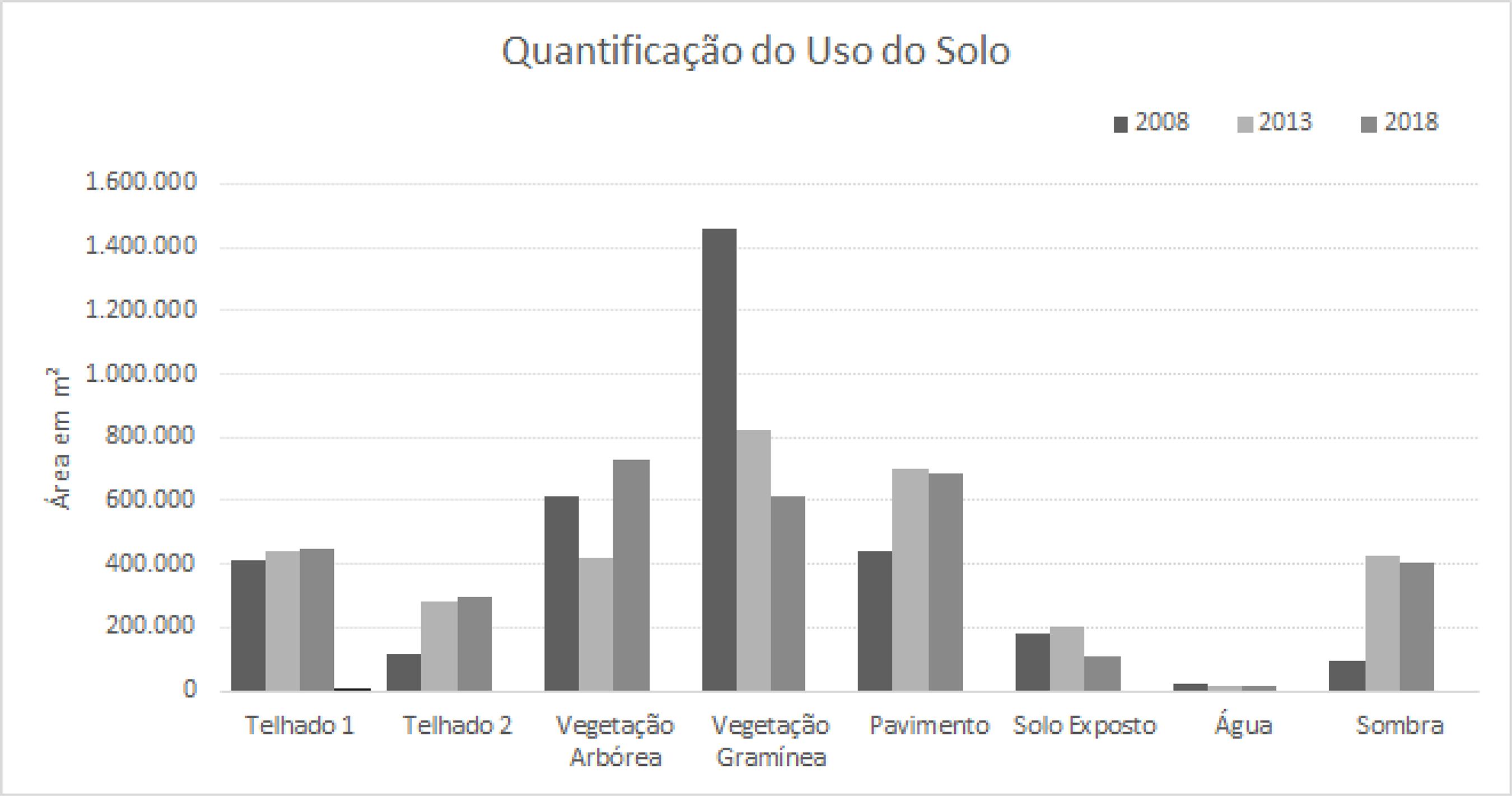
The analysis of the dynamics of changes in patterns of land use and occupation, which is essential for the planning of urban areas, can be done indirectly through remote sensing orbital images. Orbital images have proven to be important tools for measuring and monitoring human activities on Earth. Thus, this paper aims to map the surrounding areas of Passeio das Águas Shopping Center, located in the northern region of Goiânia, Brazil, assigning to it the condition of Travel Generator (TG). Hence, this study analysed the dynamics of change in land use and cover in its surroundings. The methodology used was based on the digital processing of orbital images in a Geographic Information System (GIS) environment. The results showed that, in a 10-year interval, there was a reduction of the vegetation area, and a significant increase in the paved and built areas, promoting significant changes in the land use pattern after the implementation of the TG.
Keywords:
Mapping in urban area; Remote sensing; Travel generator
 Fonte: elaborado a partir de
 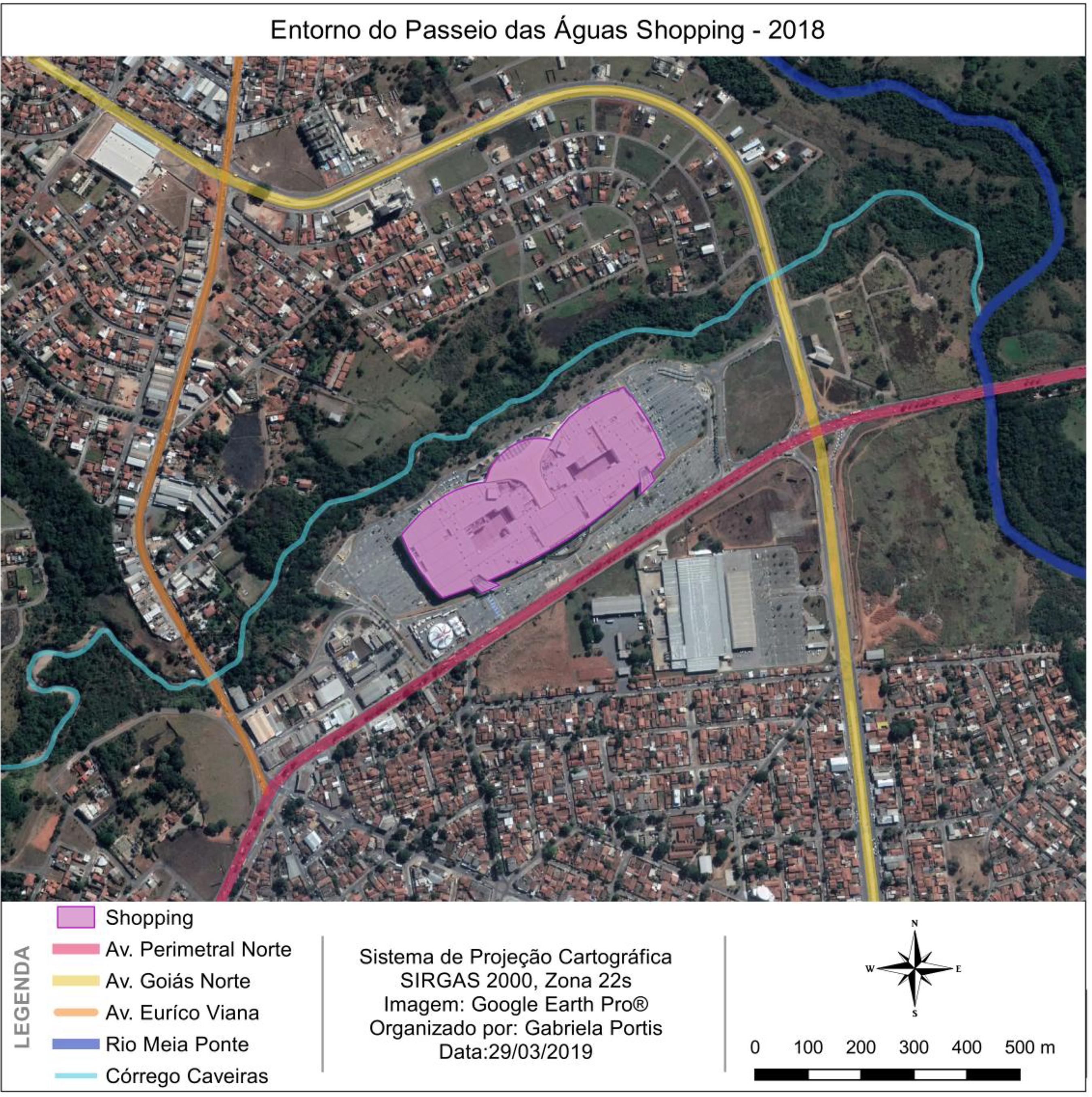 Fonte: elaborado a partir do Google Earth Pro (2018).
 Fonte: elaborado a partir de
  Fonte: elaborado a partir de