Abstract
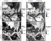
Changes resulting from land use and occupation modify the surface radioactive balance. This paper evaluated the impact on the net radiation caused by the conversion of a Cerrado area in an agricultural zone in the southern Mato Grosso using Landsat 5 TM sensor imagery acquired between June and October 2011. The analyses were performed of the following land use classes: Cerrado, riparian vegetation, sugarcane, soybean, pasture, bare soil and water. The replacement of Cerrado by agricultural areas changed the biophysical indices of the surface due to the change in biomass and the optical properties of the surface as observed in this study. The NDVI values were higher in the typical Cerrado vegetation and Riparian Forest than in agricultural areas. The surface temperature and the surface albedo showed an inverse pattern of NDVI, with lower values in the typical Cerrado vegetation and Riparian Forest and higher values in agricultural areas and bare soil. The replacement of Cerrado by cultivated crops in the south of Mato Grosso decreased the available energy at the surface, as indicated by the radiation balance.
Keywords:
deforestation; energy exchange; land use planning; satellite imagery

 Thumbnail
 Thumbnail
 Thumbnail
 Thumbnail
 Thumbnail
 Thumbnail
 Thumbnail
 Thumbnail
 Thumbnail
 Thumbnail
 Thumbnail
 Thumbnail
 Thumbnail
 Thumbnail
 Thumbnail
 Thumbnail
 Thumbnail


