person Franciny Lieny Souza
Data collection · data analysis · writing
school Universidade do Estado de Santa Catarina, Departamento de Engenharia Florestal, Lages - Santa Catarina, Brasil. E-mail: francinylieny@hotmail.com; marcos.schimalski@udesc.br; veraldo.liesenberg@udesc.br; jean.sampietro@udesc.brUniversidade do Estado de Santa CatarinaBrazilLages, Santa Catarina, Brazil Universidade do Estado de Santa Catarina, Departamento de Engenharia Florestal, Lages - Santa Catarina, Brasil. E-mail: francinylieny@hotmail.com; marcos.schimalski@udesc.br; veraldo.liesenberg@udesc.br; jean.sampietro@udesc.br
person Marcos Benedito Schimalski
Conceptualization · methodology · final approval
school Universidade do Estado de Santa Catarina, Departamento de Engenharia Florestal, Lages - Santa Catarina, Brasil. E-mail: francinylieny@hotmail.com; marcos.schimalski@udesc.br; veraldo.liesenberg@udesc.br; jean.sampietro@udesc.brUniversidade do Estado de Santa CatarinaBrazilLages, Santa Catarina, Brazil Universidade do Estado de Santa Catarina, Departamento de Engenharia Florestal, Lages - Santa Catarina, Brasil. E-mail: francinylieny@hotmail.com; marcos.schimalski@udesc.br; veraldo.liesenberg@udesc.br; jean.sampietro@udesc.br
person Veraldo Liesenberg
Editing · literature review
school Universidade do Estado de Santa Catarina, Departamento de Engenharia Florestal, Lages - Santa Catarina, Brasil. E-mail: francinylieny@hotmail.com; marcos.schimalski@udesc.br; veraldo.liesenberg@udesc.br; jean.sampietro@udesc.brUniversidade do Estado de Santa CatarinaBrazilLages, Santa Catarina, Brazil Universidade do Estado de Santa Catarina, Departamento de Engenharia Florestal, Lages - Santa Catarina, Brasil. E-mail: francinylieny@hotmail.com; marcos.schimalski@udesc.br; veraldo.liesenberg@udesc.br; jean.sampietro@udesc.br
person Jean Alberto Sampietro
Conceptualization
school Universidade do Estado de Santa Catarina, Departamento de Engenharia Florestal, Lages - Santa Catarina, Brasil. E-mail: francinylieny@hotmail.com; marcos.schimalski@udesc.br; veraldo.liesenberg@udesc.br; jean.sampietro@udesc.brUniversidade do Estado de Santa CatarinaBrazilLages, Santa Catarina, Brazil Universidade do Estado de Santa Catarina, Departamento de Engenharia Florestal, Lages - Santa Catarina, Brasil. E-mail: francinylieny@hotmail.com; marcos.schimalski@udesc.br; veraldo.liesenberg@udesc.br; jean.sampietro@udesc.br
person Bill Herbert Ziegmaier
Drafting
school Universidade do Estado de Santa Catarina, Departamento de Engenharia Florestal, Lages - Santa Catarina, Brasil. E-mail: francinylieny@hotmail.com; marcos.schimalski@udesc.br; veraldo.liesenberg@udesc.br; jean.sampietro@udesc.brUniversidade do Estado de Santa CatarinaBrazilLages, Santa Catarina, Brazil Universidade do Estado de Santa Catarina, Departamento de Engenharia Florestal, Lages - Santa Catarina, Brasil. E-mail: francinylieny@hotmail.com; marcos.schimalski@udesc.br; veraldo.liesenberg@udesc.br; jean.sampietro@udesc.br
Edited by Silvana Philippi Camboim and Márcio Augusto Reolon Schmidt

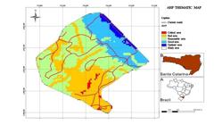
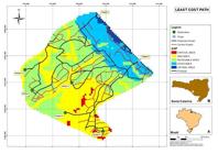
 Analytic Hierarchy Process (AHP) and GIS applied to the adequacy of forest roads in southern Brazil
 Thumbnail
 Thumbnail
 Thumbnail