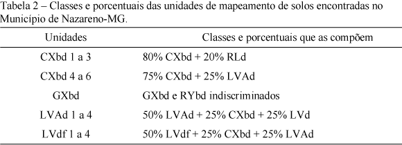
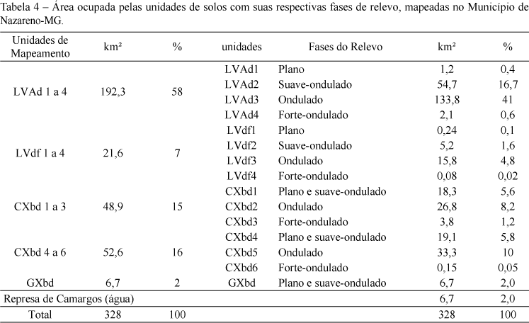
This research was carried out in Nazareno County, State of Minas Gerais, which has been subjected to serious environmental problems due to inadequate soil use. Information about soils is necessary for the appropriate monitoring when implementing measures to mitigate or correct the problem. The objective of this work was to produce a soil recognition map. It is intended to subsidize future and more detailed mapping of the area. The choice of the work area was due to the high degree that the erosive processes reached in Nazareno. Geographic Information Systems (GIS) aided the mapping process and the investigation, minimizing costs and increasing the quality and precision of the results. Five soil mapping units were defined: LVAd (58%) was predominant, followed by CXbd2 (16%), and CXbd1 (15%). The unit LVdf (7%) occurs in the north of the municipal district and the unit GXbd occupies the smallest area (2%).
Soil survey; geographic information system; pedology