
Abstract
The aim of this article is to analyze the relationship between socio-spatial segregation and provision of health services in the Metropolitan Region of Belo Horizonte in 2010. Data from the Population Census, the National Register of Health Establishments and the Annual Record of Social Information were used. The data were organized in weighting areas through the extraction of geographic coordinates and analyzed through descriptive statistics and spatial correlation. The results show that the public primary care services were concentrated in areas where lower socio-occupational groups in the social hierarchy predominated, although the availability of doctors did not follow the same logic. Private services, in turn, were located in areas segregated by intermediate and higher groups, mainly in the capital city.
socio-spatial segregation; health services; spatial analysis; Metropolitan Region of Belo Horizonte; spatial correlation
 Fonte: elaboração própria, a partir dos dados do Censo Demográfico de 2010.
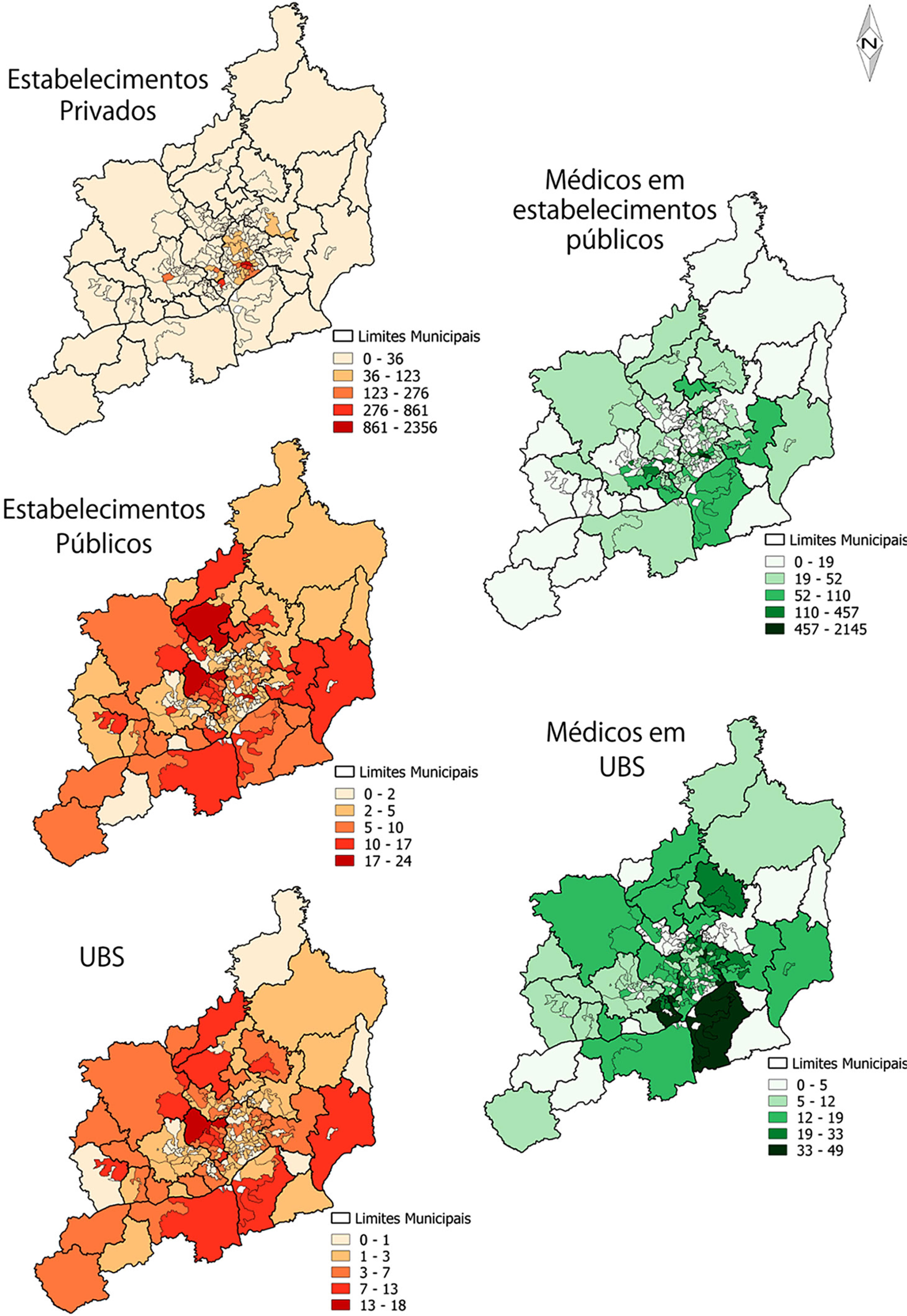 Fonte: elaboração própria, a partir dos dados do Cadastro Nacional de Estabelecimentos de Saúde e da Relação Anual de Informações Sociais.* Full Time Equivalent: cada 40 horas semanais de trabalhos médicos em serviços de saúde corres-pondem a um médico.