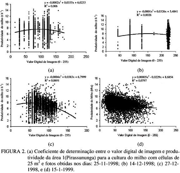
Precision Agriculture is being used as an alternative for improving production in developed countries. In Brazil it is just starting and research contribution is fundamental in the process of its adoption. This work aimed to study the potential use of 35 mm color aerial photos to predict yield in grain crops. Some fields are been intensivelly monitored and data are been taken, like yield maps, physical and chemical soil properties, weeds, diseases and pests and also 35 mm color aerial photos. The photos were georeferenced by ground flags located with DGPS. After selecting the best photos, they were scanned. The images and yield maps were processed and the regressions between images and yield were analized. Low determination coefficients were obtained in all cases, showing little potential for this kind of information on predicting yield variability in the field.
precision agriculture; spacial variability; remote sensing