SOIL EROSION ANALYSIS IN THE INFLUENCE AREA OF TIETÊ PARANÁ HYDROWAY (TIETÊ BRANCH)
The Tietê-Paraná Hydroway corresponds to 2.400 kilometers of navigable area between the Tietê and Paraná rivers, integrating six Brazilian states: São Paulo, Paraná, Goiás, Mato Grosso, Mato Grosso do Sul and Minas Gerais. It stands from the municipality of Conchas in São Paulo State and ends in the lake of the Itaipu Hydroelectric Power Plant in Paraná State, comprising 1.642 km of major routes and 758 km of secondary routes.
The area of study includes six hydrological basins in the influence area of the Tietê-Paraná Hydroway particularly in its Tietê Branch, involving the territorial area of 225 municipalities which consist of 28% of the total number of municipalities and 23% of the total population of São Paulo State. Inside these basins there are some densely populated urban areas and the major industrial region of the inner portion of São Paulo State.
The main technical parameters used in the soil erosion analysis consists of: the natural soil erosion susceptibility of the terrains and the land use types, considering the effects of the land use in each particular terrain.
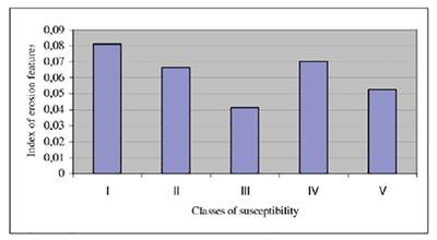
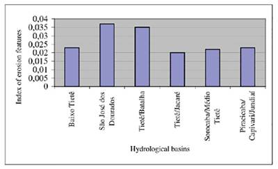
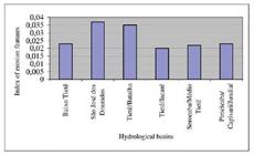
By using aerial photographs of 1972 and field investigation data of 1990, linear erosion incidences were mapped. A value of erosion density was achieved considering the number of linear erosions and the area of each hydrological basin.
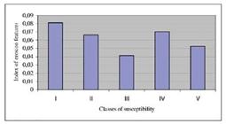
The critical basins for the occurrence of linear erosion were obtained by considering the value of erosion density and the natural erosion susceptibility of the terrains. The maior critical areas present high and very high erosion susceptibility, and great number of linear erosion processes.
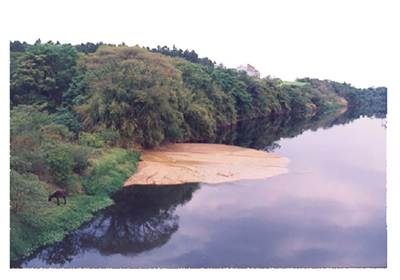
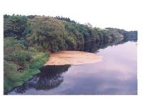
It was also possible to identify the municipalities with great potential to generate impacts to the Hydroway by considering: the urban erosion condition, number of linear erosions in rural areas and the classes of high and very high susceptibility existing in the municipal area. The silting up of sediments in the border of reservoirs in the main channel of navigation and in transposition points (bridges, landfills, terminals and others) are the major impacts due to erosion processes in the region.
Key-Words:
erosion; Tietê-Paraná Hydroway
 Thumbnail
 Thumbnail
 Thumbnail
 Thumbnail