 RECUPERAÇÃO AMBIENTAL PELO PLANEJAMENTO DO USO DA TERRA DA SUB-BACIA HIDROGRÁFICA DO RIO SOTURNO, RS, COM BASE NO COEFICIENTE DE RUGOSIDADE
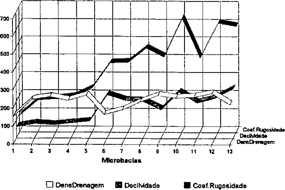
The sub-watershed of Soturno river, located at Santa Maria, RS, is part of the watershed of Jacuf river, that forms Guaíba river. The sedimentation of the Lagoa dos Patos and the poverty of country region are consequences of the bad management of land in Rio Grande do Sul. Among several parameters, the Ruggedness Number shows well the environmental conditions, and is easily obtained through fundamental data and interpretation of aerophotograms and orbital images TM LANDSAT.
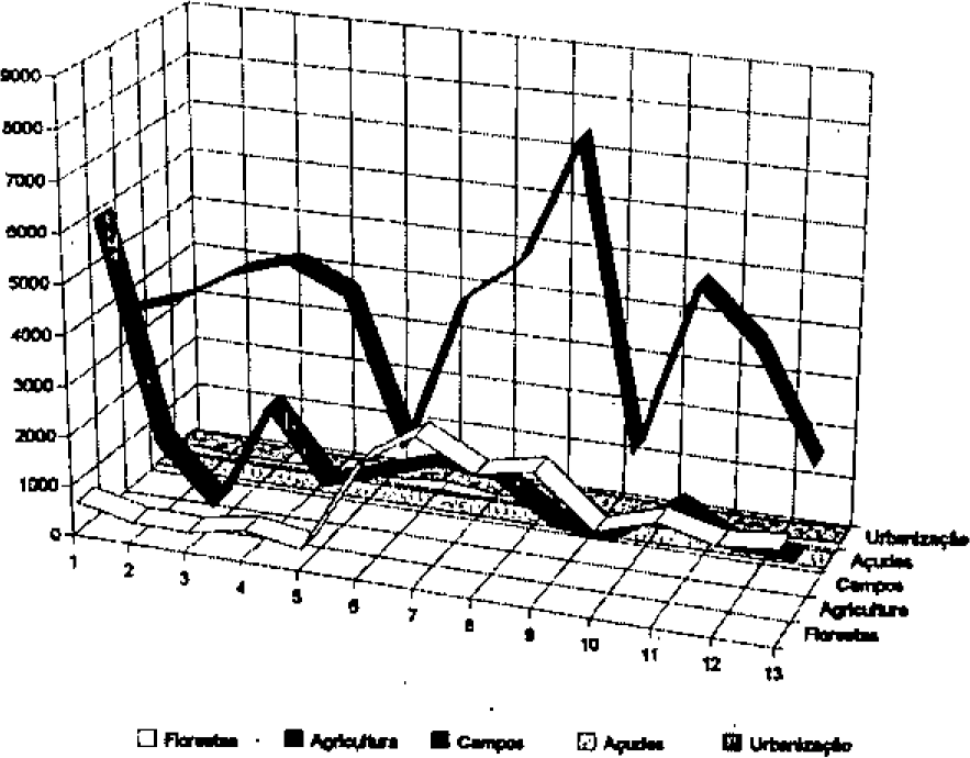
It was determined 13 micro-watersheds in Soturno river's watershed, characterizing the land uses as agricultural, bovine cattle-breeding and forestal, management. It was found conflicts in land uses and high degree of environmental deterioration, that gave support to rational uses of land proposal.
Key Words:
WATERSHED; USE OF LAND; RUGGEDNESS NUMBER.
 Thumbnail
 Thumbnail
 Thumbnail